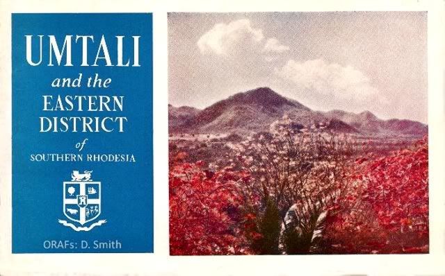
Umtali and the Eastern Districts of Southern Rhodesia
Maps by L. F. Hughes: Sketches by W. Peacock.
Published by :
THE MUNICIPALITY OF UMTALI,
P.O. Box 91,
UMTALI
in conjunction with
THE EASTERN DISTRICTS REGIONAL DEVELOPMENT AND PUBLICITY ASSOCIATION,
P.O. Box 69, Umtali
Designed and Printed by :
The Rhodesian Printing and Publishing Co., Ltd.,
P.O. Box 96, Umtali.
JUNE.......1953
Recompiled by Eddy Norris from files made available to me by Diarmid Smith. Thank you Diarmid
Front cover photograph: A farm near Umtali by W. Erlach:
History of Umtali
In 1505 the Portuguese captured the Arab coastal settlement of Sofala in what is now the Colony of Mocambique and laid claim to sovereignty over the hinterland. The extent of the area was naturally unknown, but rumours of untold riches emboldened some of the more adventurous spirits of those days to penetrate inwards towards the legendary land of Ophir (Zimbabwe) in search of gold and silver. There is evidence that throughout the sixteenth, seventeenth, eighteenth and nineteenth centuries various expeditions entered the great Empire of Monomotapa, which extended from the Zambesi to the Limpopo.
On the 12th September, 1890, the wave of British penetration from the south, inspired by the genius and far-sightedness of Cecil John Rhodes, reached the spot on which Salisbury now stands. Subsequent expansion south-eastwards brought the Pioneers into Manicaland where Fort Umtali was built near the junction of the Sambi and Umtara Rivers.
This advance of British civilisation was not accomplished without great opposition both from nature and man. For instance, there were numerous incidents with the Portuguese over disputed land, but eventually arbitration settled the watershed of the Sabi and Pungwe Rivers as a rough demarcation between the interests of the two contending parties.
In 1891 Fort Umtali was abandoned, as the new B.S.A. Company had inadvertently omitted to secure the site to themselves, and enterprising gold prospectors, taking advantage of this lack of restriction on their activities, pegged the land, including the Fort itself.
In consequence the police and the volunteers then moved to Old Umtali, nine miles north of the present town, where between 1891 and 1897 a virile settlement, attracted by the prospects of extensive mineral development, sprang up and flourished.Hotels, business houses and Government buildings were erected, the telegraph was extended from Fontes Villa—then the terminus of the Railway—and the first newspaper " Rhodesia Advertiser," now called " The Umtali Post," made its appearance.
It was here, in 1891, after riding from Beira to meet Dr. Jameson, that Rhodes first saw the land which was to perpetuate his name.
With the opening up of Melsetter by the Moodie Trek and Chipinga by the Steyn Trek, the importance of Umtali as a centre of trade increased rapidly, and a party was consequently sent to cut a road to the south to enable the new settlers to bring their produce into market.
Rhodes had already given orders for the construction of the railway from Beira into Rhodesia and had promised that it would pass through the new township of Umtali on its way.Unforeseen engineering difficulties, however, made this promise impossible of fulfillment.
To assuage the natural consternation in the minds of the settlers, Rhodes offered to compensate these people once more to move their place of residence to another area which was accessible to the railway. A committee of Old Umtali residents, which was appointed at a public meeting, chose the present site to which, on receipt of £50,000 the entire population moved. The abandoned town lands of Old Umtali were presented to the American Episcopal Church on condition that it established an industrial mission for natives and a school for white children in new Umtali. This latter is the genesis of the present Umtali High School.

On the 4th February, 1898, the railway reached Umtali, which remained the terminus until in the next year the line was continued to Salisbury.
With the establishment of communications and the consequent increase of inhabitants, Umtali entered upon a new era of prosperity. The development has been marked during recent years.
Rhodes's interest did not cease with the formation of the new town. He issued orders that the main highway between Penhalonga and Umtali should be maintained in perpetuity by the Government; he initiated the work of planting, in great numbers, the flamboyant trees which now add so greatly to the general attractiveness of the town; he gave instructions concerning the layout of the present Park and also presented a large tract of
land which, until recently, served as a racecourse.
The town, in its early days, was administered by a Sanitary Board. Only in 1914 was it promoted to the status of a Municipality and the Mayoral Chain now in use was a gift from the B.S.A. Company and was presented by Dr. Jameson on a visit in the same year.
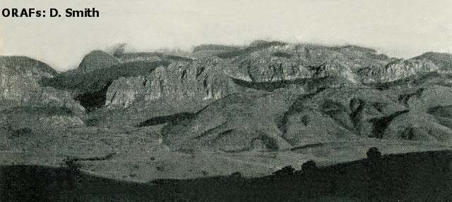
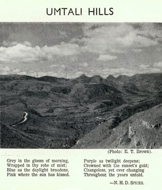
The mighty Chimanimani range of mountains reaches a height of over 8,000 ft.
At its foot lies the delightful little milage of Melsetter, one of the first settlements
to be established in the Eastern Districts.
(Photo: E. T. Brown).
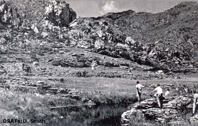
A close-up of one of the more rugged mountains in the District.
Several peaks offer a strong challenge to even the hardiest mountaineers.
(Photo: Public Relations Dept. of S.H.)


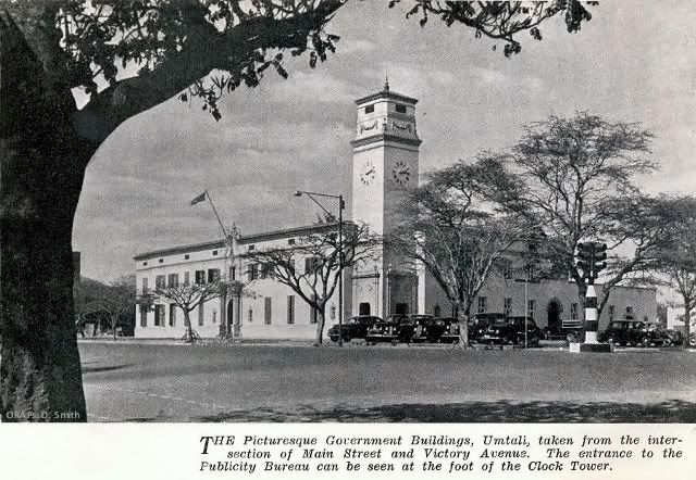
Umtali the Modern Town
Umtali, the third largest town and most picturesque in the Colony, is the port of entry into Southern Rhodesia from Portuguese East Africa. It is 170 miles from Salisbury, the capital, to the west, and 202 miles from Beira, the East Coast port, which makes Umtali an important distributing centre, and is served by road, rail and telegraph. An air service to Salisbury operates from Grand Reef, Umtali's airport, 17 miles to the west of the town.
Situated at an altitude of 3,500 feet, Umtali has a pleasant climate for the greater part of the year and even during the hottest months there is generally a cool breeze at night.
The maximum and minimum temperatures vary between 80° and 96° Fah. and 40° and 60° Fah. respectively. The average yearly rainfall, taken over a period of 10 years, is 32.5" and the relative humidity at 8.30 a.m. is 73.
In common with most places in the world accommodation has been short, especially in the hotels. There is, however, a large building programme in hand and a number of Umtali hotels are being enlarged and modernised.
The Municipal Council are continually opening new areas for housing. Residential stands within the Municipal area, from one-third of an acre upwards, may be purchased at from £120 to £700 per acre, while the cost of a reasonable three- bedroomed house is from £3,000 upwards.
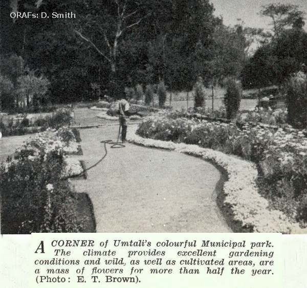
It is noticeable that the commercial and industrial development of Umtali has not impaired its scenic beauty: the town is well planned and most of its broad streets are lined with shady flowering trees, which, at seasons, present a riot of colour.
For the music lover, the Municipal Orchestra is now well established, with some 30 instrumentalists.
There are also Dramatic and Debating Societies and a Mountain Club.
The Vumba Heights, situated about 5,000 feet above sea level in probably the finest scenery and air in the Colony, is a convalescent home for boys and girls to recuperate and continue their education.
Umtali is the centre of a most beautiful and fertile area, the demarcation being Umtali, Makoni, Inyanga and Melsetter/Chipinga, and consequently has several secondary industries based on agriculture.
The Eastern District lends itself to mixed farming, and, in addition, is the centre of a very important tobacco area. Considerable attention is also given to afforestation (most soft woods are being grown), and in the mist belts to wattle.
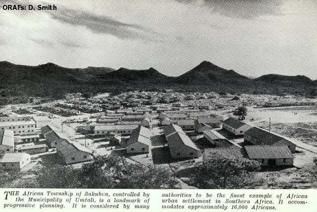
There has been great industrial development-light and heavy—and continual expansion is in evidence. Sakubva, the African Village, constructed by the Municipality is unequalled in the Colony, and comparable with the best in Southern Africa.
The population of Umtali has increased from 2,600 Europeans in 1946 to more than 6,800 today, according to the latest estimates.
With the expansion already mentioned and with the initiation and development of the scheme for development of the Sabi Valley, which it is predicted will herald a new era of prosperity to the Colony in general, the population will undoubtedly increase considerably.
To those who contemplate settling in the town, the statistical data relating to essential services on other pages in this booklet will be of interest.
UMTALI FACTS AND FIGURES I
Geographical Details
ALTITUDE
Varies from 3,450 ft. at lower end of town to 4,060 feet above sea level at upper end.
Municipal Offices, 3,635 feet.
LATITUDE
18o 57' South.
LONGITUDE
32o 41' East.
RAINFALL
Mean annual rainfallL 32.5 inches
(Based on average of 40 years)
TEMPERATURE
Mean average (maximum): 78°
Mean average (minimum): 57°
HEALTH
Equable climate—health of population maintained at a high level. No malaria within the Municipality. First-class general hospital and a first-class maternity home.
AREA
Approximately 14,310 acres.
POPULATION
Europeans: 6,800
Coloured and Asiatic: 450
African: 19,500
Total: 26,750
RATEABLE VALUE
Land: 1,396,495
Improvements: 3,191,680
Excluding Government property: £4,588,175
ROAD DISTANCES FROM MAIN CENTRES
Umtali to
Salisbury: 170 miles
Bulawayo: 379 miles
Victoria Falls: 664 miles
Lusaka: 671 miles
Fort Victoria : 193 miles
Beit Bridge: 375 miles
Pretoria: 687 miles
Johannesburg: 722 miles
Durban: 1149 miles
Cape Town: 1644 miles
Beira: 202 miles

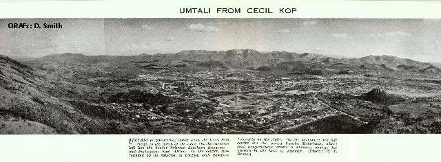
Umtali in panorama, taken from the Cecil Kop range to the north of the town.
On the extreme left lies the border between Southern Rhodesia and Portuguese East Africa.
In the centre, surrounded by its suburbs, is Umtali, with Sakubva Township on the right.
On the horizon to the left centre are the famed Vumba Mountains, where cool
temperatures create a pleasing change for vistors in the heat of summer.
(Photo: E. T.Brown).
UMTALI FACTS AND FIGURES—II
Municipal Services and Industrial Development
MUNICIPAL CHARGES
Electricity :
Charges range from 1s. per unit for the first three units, per room per month to
3/4d. per unit for domestic consumption. Charges for other types of consumption (other than power) vary between 1s. and 3/4d. per unit. The foregoing charges are subject to a surcharge of 10%. Electric power for light industrial establishments is charged at between 2d. and 1 and 1/quarter d. per unit; heavy power users pay 10s. per month per K.V.A. of maximum demand plus .475d. for the first 50,000 units per month and .45d. per unit thereafter.
Water:
Owing to present restricted supplies (which will become unlimited before the end of 1953) a punitive tariff is in existence at present. However, an adequate quota is available for domestic consumption at 4s. 2d. per 1,000 gallons. Industrial consumers pay 2s. 6d. per 1,000 gallons.
Sewerage :
Charge for average house £1 per month.
Rubbish Removal :
Charge for average house 7s. 6d. per month.
Land
Residential
Stands vary from 1/3 to 1 1/2 acres at prices from £120 to £700.
Industrial, Light
(no rail siding) £400 per acre.
Heavy (rail siding)
£500 per acre.
Building Clauses
Residential buildings to the value of from £2,500 upwards, depending on locality, must be erected within two years.
Industrial
Buildings to the value of £1,500 (light) and £2,000 (heavy) per acre or part thereof must be erected within two years.
Main Industries in Umtali
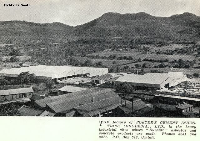
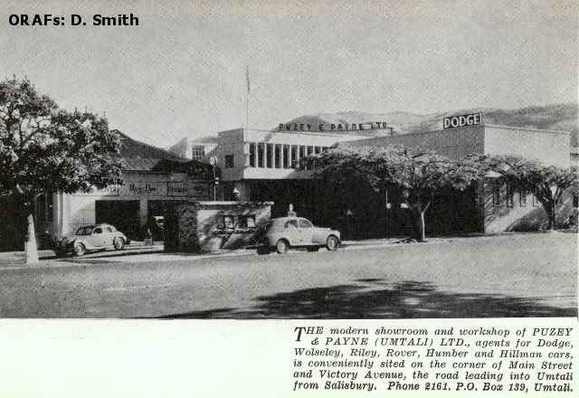
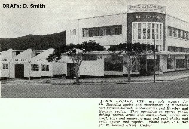
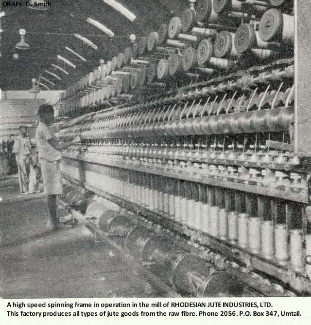
Asbestos cement roofing, spun concrete pipes, board and paper manufacture, jute industries, dehydration fruit and vegetables, saw mills, furniture manufacture, jam manufacture, fruit canning, precision engineering, laundry, clothing, flour milling, steel prefabrication, paint manufacture, gin distilling, parquet flooring, nail manufacture, etc.
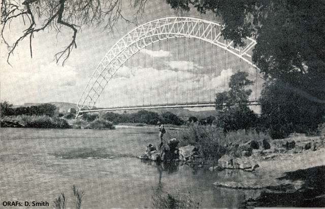
The magnificent steel arch of Birchenough Bridge spanning the Sabi River. This is the third longest single arch-span bridge in the world; height 280ft., length 1,080ft. (Photo: E. T. Brown).
The Surrounding Districts
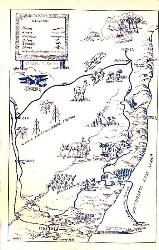
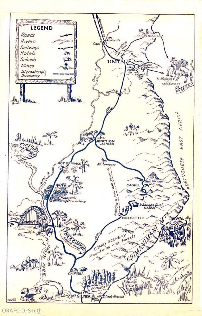
Umtali is the centre of the lovely mountain country that stretches along the Eastern Border from Inyanga in the north to Mount Silinda in the south. To north, west and south lie attractive villages, each worth a visit for what they offer in setting and scenery and friendliness.
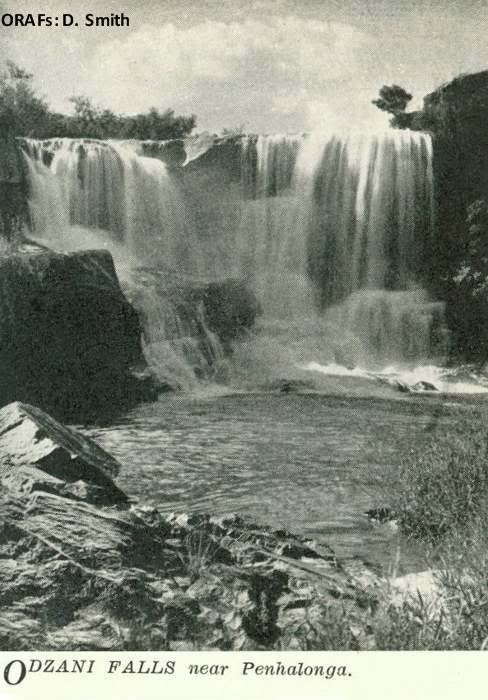
To the north-east, eleven miles from Umtali, Penhalonga nestles in a valley which is the centre of the gold-mining industry of Manicaland. North again, some sixty miles further on, is Inyanga, in a district of wooded mountains, rolling downs, deep gorges and sparkling streams and rivers.
North-west of Umtali on the main road to Salisbury, are the rich tobacco lands of Odzi, Inyazura and Rusape. Here the mountains begin to give way to rounded hills clothed in bushveld trees, with strange rock formations.
Dominating the southern approach to Umtali are the lovely Vumba mountains, where primeval forests, steep grassy valleys and crystal streams threading through lush undergrowth and tall ferns vie for the visitor's attention.
Much farther to the south the majestic rugged Chimanimani Mountains form a rampart along the border and dominate the village of Melsetter. Further south still, beyond the rich farm-lands of Chipinga, is the Mount Selinda Forest, where the ancient peace of shadowed glades is broken only by the crying of birds and perhaps the distant sound of a wood-cutter's axe.
Back on the road to Umtali, a diversion leads to the silvery arch of Birchenough Bridge, soaring above the bush to span the Sabi River. Nearer Umtali again are the natural hot springs, said to be beneficial to invalids.
Penhalonga
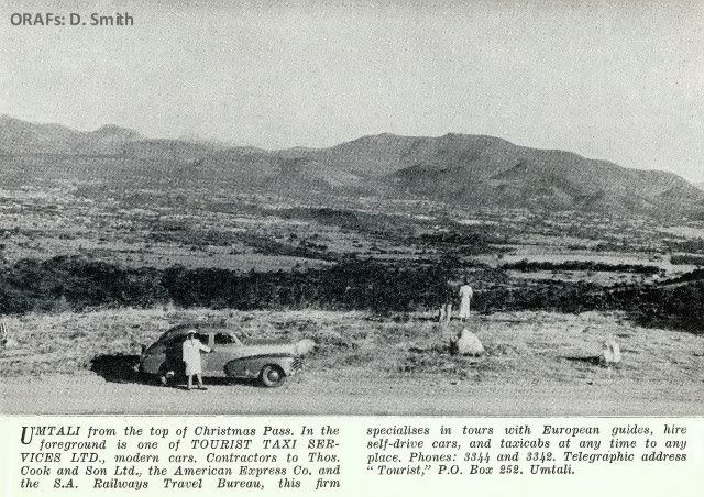
North and east across the famous Christmas Pass—so named by the Pioneers who camped there on Christmas Day, 1891—a tarred road leads to the Penhalonga Valley, nestling in the shadow of tall hills.
From here the visitor can take the winding mountain road to the border post and on through beautiful scenery to the Portuguese township of Vila de Manica, and then back up the valley through which the railway winds its way.
Just short of Penhalonga is the Imbeza Valley, a lovely spot with a big forest estate at its head.
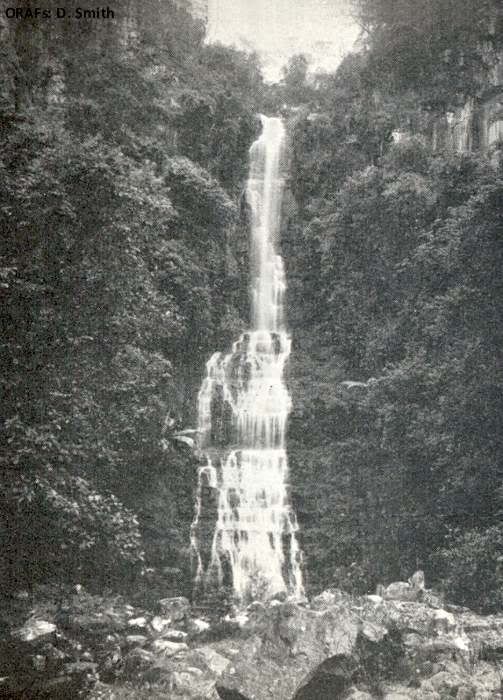
The Bridal Veil Falls near Melsetter derive their name from their
likeness to soft lace.
They are set in the rich, luxuriant green which predominates the
countryside.
Inyanga
From Penhalonga the road winds on some sixty miles northwards to the Inyanga District and the vast estate bequeathed by Cecil John Rhodes to the people of Rhodesia. Here good hotels and guest houses, trout streams and unsurpassed scenery offer rest and recreation for the traveller.
On the 4th February, 1898, the railway reached Umtali, which remained the terminus until in the next year the line was continued to Salisbury.
With the establishment of communications and the consequent increase of inhabitants, Umtali entered upon a new era of prosperity. The development has been marked during recent years.
Rhodes's interest did not cease with the formation of the new town. He issued orders that the main highway between Penhalonga and Umtali should be maintained in perpetuity by the Government; he initiated the work of planting, in great numbers, the flamboyant trees which now add so greatly to the general attractiveness of the town; he gave instructions concerning the layout of the present Park and also presented a large tract of
land which, until recently, served as a racecourse.
The town, in its early days, was administered by a Sanitary Board. Only in 1914 was it promoted to the status of a Municipality and the Mayoral Chain now in use was a gift from the B.S.A. Company and was presented by Dr. Jameson on a visit in the same year.
The mighty Chimanimani range of mountains reaches a height of over 8,000 ft.
At its foot lies the delightful little milage of Melsetter, one of the first settlements
to be established in the Eastern Districts.
(Photo: E. T. Brown).
A close-up of one of the more rugged mountains in the District.
Several peaks offer a strong challenge to even the hardiest mountaineers.
(Photo: Public Relations Dept. of S.H.)
Umtali the Modern Town
Umtali, the third largest town and most picturesque in the Colony, is the port of entry into Southern Rhodesia from Portuguese East Africa. It is 170 miles from Salisbury, the capital, to the west, and 202 miles from Beira, the East Coast port, which makes Umtali an important distributing centre, and is served by road, rail and telegraph. An air service to Salisbury operates from Grand Reef, Umtali's airport, 17 miles to the west of the town.
Situated at an altitude of 3,500 feet, Umtali has a pleasant climate for the greater part of the year and even during the hottest months there is generally a cool breeze at night.
The maximum and minimum temperatures vary between 80° and 96° Fah. and 40° and 60° Fah. respectively. The average yearly rainfall, taken over a period of 10 years, is 32.5" and the relative humidity at 8.30 a.m. is 73.
In common with most places in the world accommodation has been short, especially in the hotels. There is, however, a large building programme in hand and a number of Umtali hotels are being enlarged and modernised.
The Municipal Council are continually opening new areas for housing. Residential stands within the Municipal area, from one-third of an acre upwards, may be purchased at from £120 to £700 per acre, while the cost of a reasonable three- bedroomed house is from £3,000 upwards.
It is noticeable that the commercial and industrial development of Umtali has not impaired its scenic beauty: the town is well planned and most of its broad streets are lined with shady flowering trees, which, at seasons, present a riot of colour.
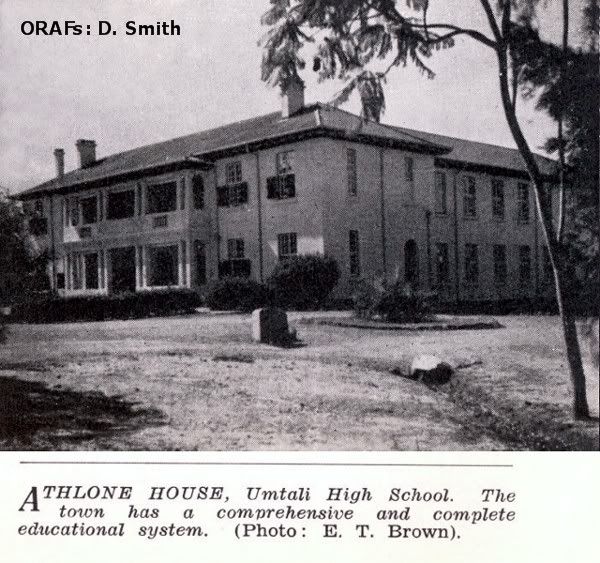
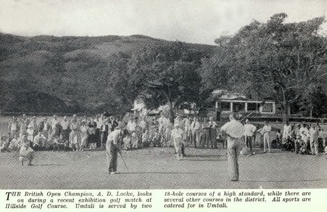
It is a busy commercial town with imposing buildings, attractive homes and all modern amenities, which include a good Government General Hospital, with separate Maternity Home; Government and private schools,and on the Vumba the Eagle Preparatory School: two modern Cinemas, a very busy and attractive shopping area, branches of the Standard Bank of S.A. Limited, and Barclay's Bank D.C. & O., well-equipped libraries and facilities for every branch of sport, with well laid out recreation grounds. There are two golf courses set in picturesque surroundings, and Churches of all denominations. An open area on Christmas Pass is set aside for campers, with water and fuel supplies available.
A Central Sports Area is, at present, under construction, which will meet the requirements of most sections of sport (Cricket, Rugby, Soccer, Hockey, Baseball, Softball and Tennis). The grounds are situated in beautiful surroundings and give promise of becoming one of the finest sports areas in the Colony.
For the music lover, the Municipal Orchestra is now well established, with some 30 instrumentalists.
There are also Dramatic and Debating Societies and a Mountain Club.
The Vumba Heights, situated about 5,000 feet above sea level in probably the finest scenery and air in the Colony, is a convalescent home for boys and girls to recuperate and continue their education.
Umtali is the centre of a most beautiful and fertile area, the demarcation being Umtali, Makoni, Inyanga and Melsetter/Chipinga, and consequently has several secondary industries based on agriculture.
The Eastern District lends itself to mixed farming, and, in addition, is the centre of a very important tobacco area. Considerable attention is also given to afforestation (most soft woods are being grown), and in the mist belts to wattle.
There has been great industrial development-light and heavy—and continual expansion is in evidence. Sakubva, the African Village, constructed by the Municipality is unequalled in the Colony, and comparable with the best in Southern Africa.
The population of Umtali has increased from 2,600 Europeans in 1946 to more than 6,800 today, according to the latest estimates.
With the expansion already mentioned and with the initiation and development of the scheme for development of the Sabi Valley, which it is predicted will herald a new era of prosperity to the Colony in general, the population will undoubtedly increase considerably.
To those who contemplate settling in the town, the statistical data relating to essential services on other pages in this booklet will be of interest.
UMTALI FACTS AND FIGURES I
Geographical Details
ALTITUDE
Varies from 3,450 ft. at lower end of town to 4,060 feet above sea level at upper end.
Municipal Offices, 3,635 feet.
LATITUDE
18o 57' South.
LONGITUDE
32o 41' East.
RAINFALL
Mean annual rainfallL 32.5 inches
(Based on average of 40 years)
TEMPERATURE
Mean average (maximum): 78°
Mean average (minimum): 57°
HEALTH
Equable climate—health of population maintained at a high level. No malaria within the Municipality. First-class general hospital and a first-class maternity home.
AREA
Approximately 14,310 acres.
POPULATION
Europeans: 6,800
Coloured and Asiatic: 450
African: 19,500
Total: 26,750
RATEABLE VALUE
Land: 1,396,495
Improvements: 3,191,680
Excluding Government property: £4,588,175
ROAD DISTANCES FROM MAIN CENTRES
Umtali to
Salisbury: 170 miles
Bulawayo: 379 miles
Victoria Falls: 664 miles
Lusaka: 671 miles
Fort Victoria : 193 miles
Beit Bridge: 375 miles
Pretoria: 687 miles
Johannesburg: 722 miles
Durban: 1149 miles
Cape Town: 1644 miles
Beira: 202 miles
Umtali in panorama, taken from the Cecil Kop range to the north of the town.
On the extreme left lies the border between Southern Rhodesia and Portuguese East Africa.
In the centre, surrounded by its suburbs, is Umtali, with Sakubva Township on the right.
On the horizon to the left centre are the famed Vumba Mountains, where cool
temperatures create a pleasing change for vistors in the heat of summer.
(Photo: E. T.Brown).
UMTALI FACTS AND FIGURES—II
Municipal Services and Industrial Development
MUNICIPAL CHARGES
Assessment Bates : 5d. in the £ on land; 2d. in the £ on buildings, per annum.
Levied twice yearly.Electricity :
Charges range from 1s. per unit for the first three units, per room per month to
3/4d. per unit for domestic consumption. Charges for other types of consumption (other than power) vary between 1s. and 3/4d. per unit. The foregoing charges are subject to a surcharge of 10%. Electric power for light industrial establishments is charged at between 2d. and 1 and 1/quarter d. per unit; heavy power users pay 10s. per month per K.V.A. of maximum demand plus .475d. for the first 50,000 units per month and .45d. per unit thereafter.
Water:
Owing to present restricted supplies (which will become unlimited before the end of 1953) a punitive tariff is in existence at present. However, an adequate quota is available for domestic consumption at 4s. 2d. per 1,000 gallons. Industrial consumers pay 2s. 6d. per 1,000 gallons.
Sewerage :
Charge for average house £1 per month.
Rubbish Removal :
Charge for average house 7s. 6d. per month.
Land
Residential
Stands vary from 1/3 to 1 1/2 acres at prices from £120 to £700.
Industrial, Light
(no rail siding) £400 per acre.
Heavy (rail siding)
£500 per acre.
Building Clauses
Residential buildings to the value of from £2,500 upwards, depending on locality, must be erected within two years.
Industrial
Buildings to the value of £1,500 (light) and £2,000 (heavy) per acre or part thereof must be erected within two years.
Main Industries in Umtali
Asbestos cement roofing, spun concrete pipes, board and paper manufacture, jute industries, dehydration fruit and vegetables, saw mills, furniture manufacture, jam manufacture, fruit canning, precision engineering, laundry, clothing, flour milling, steel prefabrication, paint manufacture, gin distilling, parquet flooring, nail manufacture, etc.
The magnificent steel arch of Birchenough Bridge spanning the Sabi River. This is the third longest single arch-span bridge in the world; height 280ft., length 1,080ft. (Photo: E. T. Brown).
The Surrounding Districts
Umtali is the centre of the lovely mountain country that stretches along the Eastern Border from Inyanga in the north to Mount Silinda in the south. To north, west and south lie attractive villages, each worth a visit for what they offer in setting and scenery and friendliness.
To the north-east, eleven miles from Umtali, Penhalonga nestles in a valley which is the centre of the gold-mining industry of Manicaland. North again, some sixty miles further on, is Inyanga, in a district of wooded mountains, rolling downs, deep gorges and sparkling streams and rivers.
North-west of Umtali on the main road to Salisbury, are the rich tobacco lands of Odzi, Inyazura and Rusape. Here the mountains begin to give way to rounded hills clothed in bushveld trees, with strange rock formations.
Dominating the southern approach to Umtali are the lovely Vumba mountains, where primeval forests, steep grassy valleys and crystal streams threading through lush undergrowth and tall ferns vie for the visitor's attention.
Much farther to the south the majestic rugged Chimanimani Mountains form a rampart along the border and dominate the village of Melsetter. Further south still, beyond the rich farm-lands of Chipinga, is the Mount Selinda Forest, where the ancient peace of shadowed glades is broken only by the crying of birds and perhaps the distant sound of a wood-cutter's axe.
Back on the road to Umtali, a diversion leads to the silvery arch of Birchenough Bridge, soaring above the bush to span the Sabi River. Nearer Umtali again are the natural hot springs, said to be beneficial to invalids.
Penhalonga
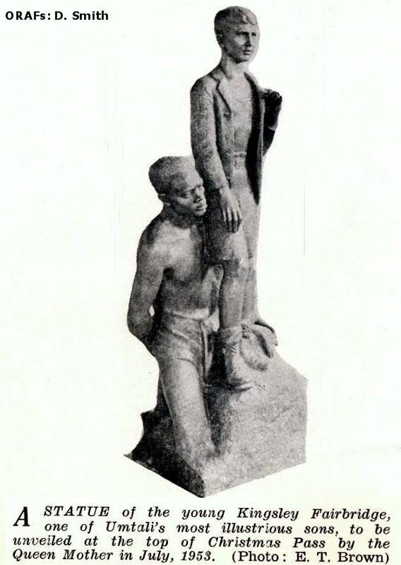
North and east across the famous Christmas Pass—so named by the Pioneers who camped there on Christmas Day, 1891—a tarred road leads to the Penhalonga Valley, nestling in the shadow of tall hills.
From here the visitor can take the winding mountain road to the border post and on through beautiful scenery to the Portuguese township of Vila de Manica, and then back up the valley through which the railway winds its way.
Just short of Penhalonga is the Imbeza Valley, a lovely spot with a big forest estate at its head.
The Bridal Veil Falls near Melsetter derive their name from their
likeness to soft lace.
They are set in the rich, luxuriant green which predominates the
countryside.
Inyanga
From Penhalonga the road winds on some sixty miles northwards to the Inyanga District and the vast estate bequeathed by Cecil John Rhodes to the people of Rhodesia. Here good hotels and guest houses, trout streams and unsurpassed scenery offer rest and recreation for the traveller.
Here lies the mass of Inyangani (8,250 feet) the highest mountain in Southern Rhodesia. There are rest huts and camping sites on part of the estate which has been set aside as a national park. Here the, traveller will find mountain, grass-land and moor, with bracken and masses of wild flowers growing beside rippling streams of cold mountain water.
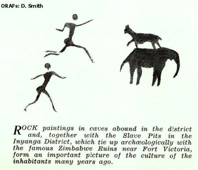
Inyanga offers many attractions for the visitor. He can ponder over the ancient " slave-pits," ruins and terraces that line one hillside after another. He can visit the breath-taking Pungwe Gorge; he can stand on the cliff-edge the Mtarazi Falls leap into the Honde Gorge nearly 1,700 feet below; he can wander in the crystal mountain air.
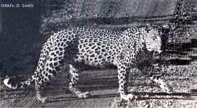
A Leopard crosses a country road. Game of all types, including lion and elephant, a
re to be found in the remoter parts of the District. Leopards, how- ever, are fairly c
ommon and are not infrequently seen on the out- skirts of Umtali itself.
(Photo: E. T. Brown).
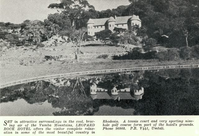
The Vumba
Drive south a few miles from Umtali, again into mountain country, the lovely softness, peace and green luxury of the Vumba—" Mist " in the native language, for the hills are often shrouded in a blanket of soft white cloud.
From Umtali, the road climbs rapidly, dipping now and then to cross a valley or tree-shadowed creek, but rising quickly to the top. As he reaches Cloudlands the traveller will meet a fresh, cooling breeze, no matter how hot it may have been in Umtali, and he will look back to see Umtali nestling happily in its girdle of hills.
Further on, from the top of the hill called " Chinyakweremba," the visitor finds opened out at his feet mountain views probably unequalled in Rhodesia. Westward, as he stands there, lies Castle Beacon, highest point in the Vumba—well worth the climb to reach the top—and beyond the mountains are glimpses of low-lying country and range after range of hills; southward lie the Chimanimani (the " Alps " of Southern Rhodesia); to the east the low-veld of Mocambique opens out, with a bold peak in the distance near Vila Pery, fifty miles away. Not one view, but many, make up this magnificent panorama.
Three hotels cater for the holiday-maker in the Vumba.
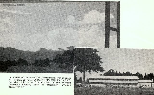
Melsetter
Melsetter - named for the Orkney home of the Moodie family who pioneered the area - has been claimed, with some justice, to be the queen of the beauty of the Eastern Districts.
The village lies in glorious hill country at the foot of the great Chimanimani Mountains that skirt the Mocambique Border and run north and south for about 30 miles.
The scenery is among the loveliest in the Colony and there is much to interest holiday-maker and naturalist in the Chimanimani National Park. The climate is clear and bracing and the tourist will see attractive farms nestling in the valleys, growing forest estates, sleek cattle and, because the area is exceptionally well watered, clear streams and entrancing waterfalls.
The road south from Umtali offers a choice of routes after Cashel. The old road, at times cut out of the sheer mountain side, winds through glorious country. The new road, a fine piece of engineering planned to give easy motoring, reaches its peak at Skyline where the traveller is rewarded with breathtaking views for miles around.
About three miles from Melsetter is the delicate lace-like Bridal Veil waterfall, and the short drive to the top of Pork Pie Hill is well worth while.
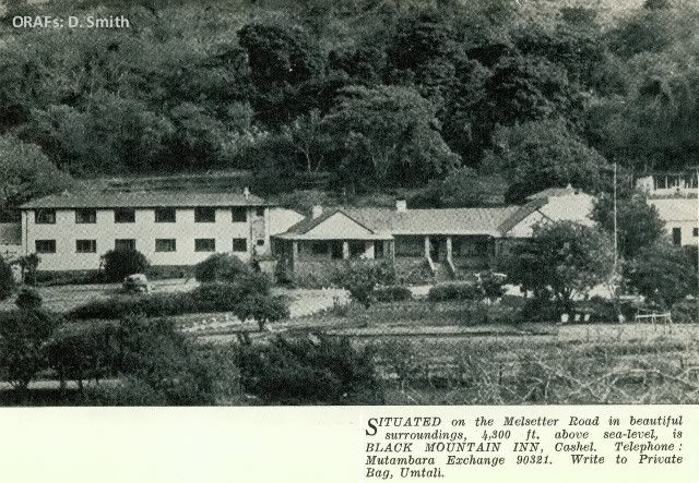
A modern hotel was recently opened at Melsetter.
Chipinga
Another 40-odd miles of winding road takes the visitor to Chipinga, and it is worth while to stop on the way to see Silver Streams, a succession of glittering cascades of water where a river crosses the main road.
The Chipinga district, an excellent farming area, is distinguished also for its scenery and many mountain streams, and above all else for the finest natural timber in Southern Rhodesia.
Tucked away in a corner of the district is the amazing Mount Selinda forest, a burst of great trees springing up unexpectedly in a stretch of relatively open country.
The natives, always apt in the names they choose, named this belt of primeval forest the " Refuge," for the forest rises from the veld as if it were put there as a sanctuary for fugitive man or beast.
The drive through the trees is one of sheer delight. Long creepers hang in festoons from the great trunks; the gnarled and knotted parasite figs, the varied birds whose calls make a strange stir in the silence of the forest, the maze of branch and undergrowth all form a picture of great beauty. The " Big Tree," more than 200 feet high and of fabulous age, is a Khaya myassica, the so-called Rhodesian mahogany.
There is an hotel and swimming bath at Chipinga.
The Sabi Valley
The return journey from Chipinga to Umtali is through the Sabi Valley, where the scenery is more tropical than elsewhere and where investigations are now being carried out into the possibilities of immense agricultural development.
Thirty miles from Chipinga is the turn-off to Birchenough Bridge—its great arch soaring above the flat bush country around it in what has been called a " poem in steel."
Nearer still to Umtali, and on the main road is Hot Springs, where the water, rich in mineral content, bubbles out of the earth at high temperature. A swimming pool and baths are available at the hotel and the waters are gaining a high reputation for their curative properties.
Odzi Inyazura, Rusape
The final drive out of Umtali is on the main road to Salisbury, through the prosperous tobacco growing areas of Odzi, Inyazura and Rusape (the latter township is developing rapidly as a centre with industrial potentialities) where the visitor who wishes to know something about the production of the Colony's most lucrative agricultural crop will find much to hold his interest.

For the visitor, for the settler, whether still active or seeking a place for pleasant retirement, Umtali and the Eastern Districts offer delightful surroundings and a contented atmosphere wedded to energetic and enterprising commercial and industrial activities. Here the rewards of life are rich and abundant; it is worth while coming to see for yourself.
Umtali Facts and Figures III
Recreational, Educational and Religious Facilities
Sports
All the following are catered for: Badminton, Baseball, Bowls, Cricket, Golf (two 18-hole courses), Hockey, Horse Racing, Motor-Cycle and Light Car Racing, Polo, Rifle Shooting, Rugby, Soccer, Softball, Squash, Swimming, Tennis. In addition there is fishing (trout) and hunting in the district. Hiking and climbing are also popular.
Clubs
Umtali Club, Hillside Sports Club, B.E.S.L. Club, Umtali Mountain and Outdoor Club, Railway Institute. Old Borderers' Club.
Cultural Organisations
The Umtali Players (Umtali Music and Dramatic Society), Umtali Orchestral Society (Umtali Municipal Orchestra),
Umtali Choral Society, Umtali Arts Council, Umtali Sketch Club. Umtali Debating Socicty,
Umtali Branch Rhodesia National Affairs Association, Umtali Mountain and Outdoor Club (Dramatic Section).
Other Organisations
Masonic Lodges (English and Scottish Constitutions), Sons of England, Caledonian Society,Society of Yorkshiremen, Cambrian Society, Women's Institute, Loyal W omen's Guild, Business and Professional W omen's Club, Umtali Rotary Club, Chamber of Commerce, Chamber of Industries, Motor Trader's Association, Master Builders' Association.
Education
Popular Educational Centre.
At present 2,265 children at school in Umtali.
Senior High School : 660
2 Junior High Schools : 715
2 Kindergarten Schools: 310
2 Nursery Schools: 130
1 Coloured School: 150
Dominican Convent (Junior School): 300
2 Schools in Vumba Mountains.
Evening Classes held for the various trades; book-keeping, typing, shorthand, etc., at the Senior High School.
Churches
Anglican, Presbyterian, Methodist, Roman Catholic, Dutch Reformed, Greek Orthodox, etc., etc.
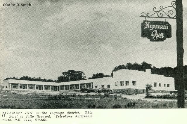
View the Nyamazi Inn Brochure by visiting this link.
Umtali Facts and Figures - IV
Communications and Hotel Charges
Communication
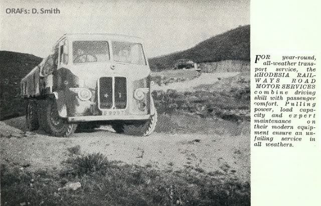
Rail : Daily passenger service to and from Salisbury and Beira.
Three passenger connections with Union of South Africa per week.
Road : Road Motor Services to all parts of the District.
Road Motor Passenger service between Umtali and Salisbury.
Air :
Monday
Salisbury Depart : 4.5 p m.
Umtali Arrive: 5.15 p.m
Tuesday
Salisbury Depart: 4.5 p m.
Umtali Arrive: 5.15 p.m
Wednesday
Salisbury Depart: 4.5 p m.
Umtali Arrive: 5.15 p.m
Friday
Salisbury Depart: 10.15 a.m
Umtali Arrive: 11.25 a.m
Monday
Depart Umtali: 6.30 a.m
Salisbury Arrive: 7.35 a.m.
Tuesday
Depart Umtali: 6.30 a.m
Salisbury Arrive: 7.35 a.m.
Wednesday
Depart Umtali: 6.30 a.m
Salisbury Arrive: 7.35 a.m.
Friday
Depart Umtali: 11.45.30 a.m
Salisbury Arrive: 12.59 a.m.
Road Distances in the District
Umtali to Melsetter: 98 miles
Umtali to Chipinga ..................109 miles
Umtali to Birchenough Bridge: 81 miles
Umtali to Odzi: 23 miles
Umtali to Inyazura: 46 miles
Umtali to Rusape: 61 miles
Umtali to Inyanga: 78 miles
Umtali to Penhalonga: 11 miles
Hotels and Boarding Houses
Licensed
(Tariffs per person)
Cecil Hotel, P.O. Box 27
£1 5 9 to £1 12 3 per day.
Royal Hotel, Main Street
£12 6 per day
Brown's Hotel, P.O. Box 86
£1 2s 6d per day
Hotel Marina, P.O. Box 22
£1 0s 0d to £1 6s 6d per day
Private
Balmoral Hotel, " C " Avenue
16s 6d per day
13s 0d per day
Woodholme, Third Street
Back Page Inner Page
Back Cover
END OF BROCHURE/BOOKLET
ORAFs records it thanks to the publishers of this booklet, the author and to the people of Umtali.
A Leopard crosses a country road. Game of all types, including lion and elephant, a
re to be found in the remoter parts of the District. Leopards, how- ever, are fairly c
ommon and are not infrequently seen on the out- skirts of Umtali itself.
(Photo: E. T. Brown).
The Vumba
Drive south a few miles from Umtali, again into mountain country, the lovely softness, peace and green luxury of the Vumba—" Mist " in the native language, for the hills are often shrouded in a blanket of soft white cloud.
From Umtali, the road climbs rapidly, dipping now and then to cross a valley or tree-shadowed creek, but rising quickly to the top. As he reaches Cloudlands the traveller will meet a fresh, cooling breeze, no matter how hot it may have been in Umtali, and he will look back to see Umtali nestling happily in its girdle of hills.
Further on, from the top of the hill called " Chinyakweremba," the visitor finds opened out at his feet mountain views probably unequalled in Rhodesia. Westward, as he stands there, lies Castle Beacon, highest point in the Vumba—well worth the climb to reach the top—and beyond the mountains are glimpses of low-lying country and range after range of hills; southward lie the Chimanimani (the " Alps " of Southern Rhodesia); to the east the low-veld of Mocambique opens out, with a bold peak in the distance near Vila Pery, fifty miles away. Not one view, but many, make up this magnificent panorama.
Three hotels cater for the holiday-maker in the Vumba.
Melsetter
Melsetter - named for the Orkney home of the Moodie family who pioneered the area - has been claimed, with some justice, to be the queen of the beauty of the Eastern Districts.
The village lies in glorious hill country at the foot of the great Chimanimani Mountains that skirt the Mocambique Border and run north and south for about 30 miles.
The scenery is among the loveliest in the Colony and there is much to interest holiday-maker and naturalist in the Chimanimani National Park. The climate is clear and bracing and the tourist will see attractive farms nestling in the valleys, growing forest estates, sleek cattle and, because the area is exceptionally well watered, clear streams and entrancing waterfalls.
The road south from Umtali offers a choice of routes after Cashel. The old road, at times cut out of the sheer mountain side, winds through glorious country. The new road, a fine piece of engineering planned to give easy motoring, reaches its peak at Skyline where the traveller is rewarded with breathtaking views for miles around.
About three miles from Melsetter is the delicate lace-like Bridal Veil waterfall, and the short drive to the top of Pork Pie Hill is well worth while.
A modern hotel was recently opened at Melsetter.
Chipinga
Another 40-odd miles of winding road takes the visitor to Chipinga, and it is worth while to stop on the way to see Silver Streams, a succession of glittering cascades of water where a river crosses the main road.
The Chipinga district, an excellent farming area, is distinguished also for its scenery and many mountain streams, and above all else for the finest natural timber in Southern Rhodesia.
Tucked away in a corner of the district is the amazing Mount Selinda forest, a burst of great trees springing up unexpectedly in a stretch of relatively open country.
The natives, always apt in the names they choose, named this belt of primeval forest the " Refuge," for the forest rises from the veld as if it were put there as a sanctuary for fugitive man or beast.
The drive through the trees is one of sheer delight. Long creepers hang in festoons from the great trunks; the gnarled and knotted parasite figs, the varied birds whose calls make a strange stir in the silence of the forest, the maze of branch and undergrowth all form a picture of great beauty. The " Big Tree," more than 200 feet high and of fabulous age, is a Khaya myassica, the so-called Rhodesian mahogany.
There is an hotel and swimming bath at Chipinga.
The Sabi Valley
The return journey from Chipinga to Umtali is through the Sabi Valley, where the scenery is more tropical than elsewhere and where investigations are now being carried out into the possibilities of immense agricultural development.
Thirty miles from Chipinga is the turn-off to Birchenough Bridge—its great arch soaring above the flat bush country around it in what has been called a " poem in steel."
Nearer still to Umtali, and on the main road is Hot Springs, where the water, rich in mineral content, bubbles out of the earth at high temperature. A swimming pool and baths are available at the hotel and the waters are gaining a high reputation for their curative properties.
Odzi Inyazura, Rusape
The final drive out of Umtali is on the main road to Salisbury, through the prosperous tobacco growing areas of Odzi, Inyazura and Rusape (the latter township is developing rapidly as a centre with industrial potentialities) where the visitor who wishes to know something about the production of the Colony's most lucrative agricultural crop will find much to hold his interest.
For the visitor, for the settler, whether still active or seeking a place for pleasant retirement, Umtali and the Eastern Districts offer delightful surroundings and a contented atmosphere wedded to energetic and enterprising commercial and industrial activities. Here the rewards of life are rich and abundant; it is worth while coming to see for yourself.
Umtali Facts and Figures III
Recreational, Educational and Religious Facilities
Sports
All the following are catered for: Badminton, Baseball, Bowls, Cricket, Golf (two 18-hole courses), Hockey, Horse Racing, Motor-Cycle and Light Car Racing, Polo, Rifle Shooting, Rugby, Soccer, Softball, Squash, Swimming, Tennis. In addition there is fishing (trout) and hunting in the district. Hiking and climbing are also popular.
Clubs
Umtali Club, Hillside Sports Club, B.E.S.L. Club, Umtali Mountain and Outdoor Club, Railway Institute. Old Borderers' Club.
Cultural Organisations
The Umtali Players (Umtali Music and Dramatic Society), Umtali Orchestral Society (Umtali Municipal Orchestra),
Umtali Choral Society, Umtali Arts Council, Umtali Sketch Club. Umtali Debating Socicty,
Umtali Branch Rhodesia National Affairs Association, Umtali Mountain and Outdoor Club (Dramatic Section).
Other Organisations
Masonic Lodges (English and Scottish Constitutions), Sons of England, Caledonian Society,Society of Yorkshiremen, Cambrian Society, Women's Institute, Loyal W omen's Guild, Business and Professional W omen's Club, Umtali Rotary Club, Chamber of Commerce, Chamber of Industries, Motor Trader's Association, Master Builders' Association.
Education
Popular Educational Centre.
At present 2,265 children at school in Umtali.
Senior High School : 660
2 Junior High Schools : 715
2 Kindergarten Schools: 310
2 Nursery Schools: 130
1 Coloured School: 150
Dominican Convent (Junior School): 300
2 Schools in Vumba Mountains.
Evening Classes held for the various trades; book-keeping, typing, shorthand, etc., at the Senior High School.
Churches
Anglican, Presbyterian, Methodist, Roman Catholic, Dutch Reformed, Greek Orthodox, etc., etc.
View the Nyamazi Inn Brochure by visiting this link.
Umtali Facts and Figures - IV
Communications and Hotel Charges
Communication
Rail : Daily passenger service to and from Salisbury and Beira.
Three passenger connections with Union of South Africa per week.
Road : Road Motor Services to all parts of the District.
Road Motor Passenger service between Umtali and Salisbury.
Air :
Monday
Salisbury Depart : 4.5 p m.
Umtali Arrive: 5.15 p.m
Tuesday
Salisbury Depart: 4.5 p m.
Umtali Arrive: 5.15 p.m
Wednesday
Salisbury Depart: 4.5 p m.
Umtali Arrive: 5.15 p.m
Friday
Salisbury Depart: 10.15 a.m
Umtali Arrive: 11.25 a.m
Monday
Depart Umtali: 6.30 a.m
Salisbury Arrive: 7.35 a.m.
Tuesday
Depart Umtali: 6.30 a.m
Salisbury Arrive: 7.35 a.m.
Wednesday
Depart Umtali: 6.30 a.m
Salisbury Arrive: 7.35 a.m.
Friday
Depart Umtali: 11.45.30 a.m
Salisbury Arrive: 12.59 a.m.
Road Distances in the District
Umtali to Melsetter: 98 miles
Umtali to Chipinga ..................109 miles
Umtali to Birchenough Bridge: 81 miles
Umtali to Odzi: 23 miles
Umtali to Inyazura: 46 miles
Umtali to Rusape: 61 miles
Umtali to Inyanga: 78 miles
Umtali to Penhalonga: 11 miles
Hotels and Boarding Houses
Licensed
(Tariffs per person)
Cecil Hotel, P.O. Box 27
£1 5 9 to £1 12 3 per day.
Royal Hotel, Main Street
£12 6 per day
Brown's Hotel, P.O. Box 86
£1 2s 6d per day
Hotel Marina, P.O. Box 22
£1 0s 0d to £1 6s 6d per day
Private
Balmoral Hotel, " C " Avenue
16s 6d per day
13s 0d per day
Woodholme, Third Street
Back Page Inner Page
Back Cover
END OF BROCHURE/BOOKLET
ORAFs records it thanks to the publishers of this booklet, the author and to the people of Umtali.
Labels: Birchenough Bridge. Rivet, Chimanimani. Melsetter, Christmas Pass.Manchester Park. Tobacco.Odzi. Inyazure. Rusape., Rhodesia. Eastern Districts, Road Motor Services. Leopard Rock
posted by Rhodesia Remembered @ 20:48
2 Comments
![]()
![]()


2 Comments:
.. thanks .. this is really nice ..
คันในร่มผ้า
มะเร็งเม็ดเลือดขาว
ถั่งเช่า
กระชาย
ข่าวการเงิน
ส้มแขก
Forex
มะกรูด
มะเขือเทศ
Post a Comment
Subscribe to Post Comments [Atom]
<< Home