Friday, 28 September 2012

Victoria Falls

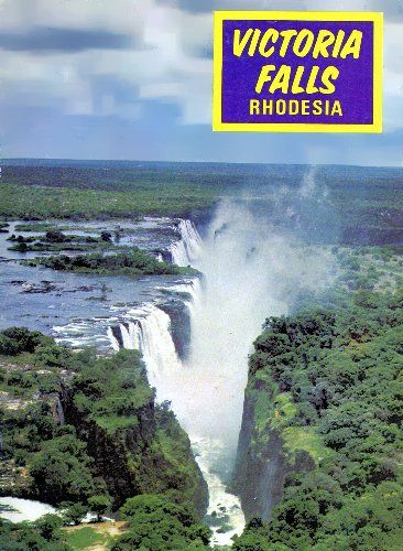
Ph1-Cover, Victoria Falls

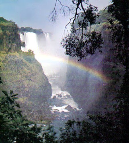
Victoria Fails is the tourist magnet of Africa. The reasons are not hard to find. The mile-wide curtain of water plunging more than 300 ft. into the gorge beneath is one of the treasured natural wonders of the world.
Ph2-1, Victoria Falls

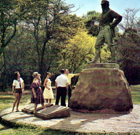
The brave missionary-explorer, Dr. David Livingstone, having heard his Africans talk of mosi-oa-tunya (the Smoke that Thunders) or of chvngwc (the Place of the Rainbow), came down-river to the Falls on November 16, 1855, to see for himself and to proclaim their existence to men at large. A  statue of him stands on the bank overlooking the Devil's Cataract. Today the Falls are almost exactly as Livingstone first saw them, unspoilt in all their grandeur. Nothing has been allowed to mar the natural beauty of the surroundings: even the disfiguring precaution of guard-rails has not been permitted.

As Livingstone stood, lost in wonder, so do many thousands of visitors each year. And in the hotels and rest camps they can relax in modern comfort, making the Victoria Falls truly an international meeting place.
Ph2-3, Victoria Falls

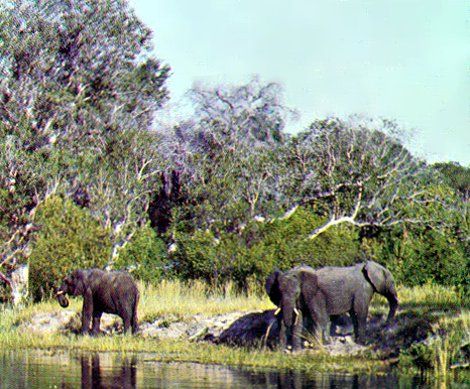
During the dry summer months, June to November, the visitor can see elephant and other game within a few miles of the village, for the Falls is the focal point of a 230-square-mile National Park, which spreads some 35 miles along the Rhodesian bank of the Zambezi.
Ph2-2, Victoria Falls

A chain-assisted path (known as the Chain Walk), descending one-third of the way down the side of the gorge, enables the visitor to see the final plunge of the Devil's Cataract and, along the full length of the gorge, a vista of the rest of the Falls.

Archaeological evidence indicates that the Falls area has been inhabited for many thousands of years, but the present inhabitants—the Tonga people—probably moved from Kasai, in what is now the Congo Republic, no more than 500 years ago. Little of their tradition and culture goes back any further than the time of David Livingstone.
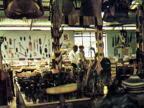
Ph2-4, Victoria FallsNevertheless, much tribal craft derives from the wealth of timber in the region, such as Rhodesian mahogany, ebony and teak, and a softwood from the Featherweight tree. A variety of carvings and many other curios may be obtained from well-stocked shops in the village.
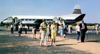

Ph3-1, Victoria FallsFrom Johannesburg, Bulawayo, Salisbury, Kariba and Wankie, more than 21 flights a week serve the new airport 15 miles south of the Falls. Visitors from the north come via Livingstone Airport, nine miles north of the Falls, in Zambia. All-inclusive Flame Lily holidays starting from most centres in Southern Africa are on sale all over the world.
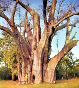
Ph3-2, Victoria Falls

From Livingstone's statue there is a path and roadway up-river to the Big Tree, a huge baobab almost 67 ft. in circumference at its base but reduced in height by a storm in 1960.
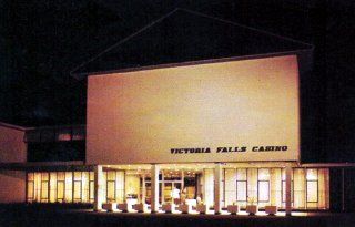
Ph3-3, Victoria Falls

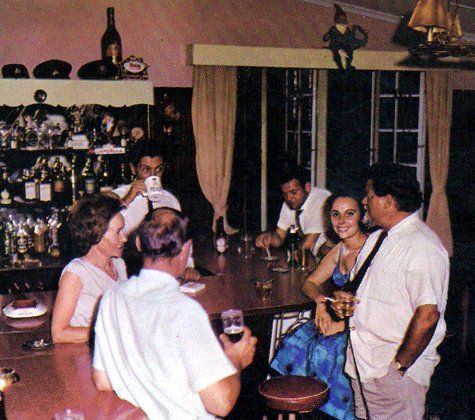
The modern, luxurious Casino Hotel was opened in 1966. It is air-conditioned throughout and has a large conference room, a bank, hairdressing salon, jewellery and other shops for the convenience of its patrons, besides a la carte restaurant serving breakfast 24 hours a day, for the convenience of patrons of the casino hall.
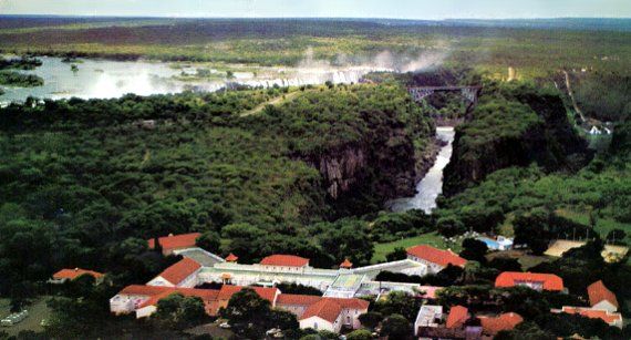
Ph3-4, Victoria Falls

The famous colonial-style Victoria Falls Hotel, with its 120 bedrooms, also has a bank, hairdressing salon and shops, as well as a conference room. Air Rhodesia and United Touring Company (offering cars for hire) have offices there. Many visitors come by rail, and there are all-inclusive Rainbow tours (by rail) from all centres in Rhodesia.
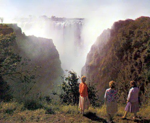
Ph4-1, Victoria Falls

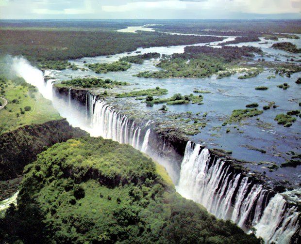
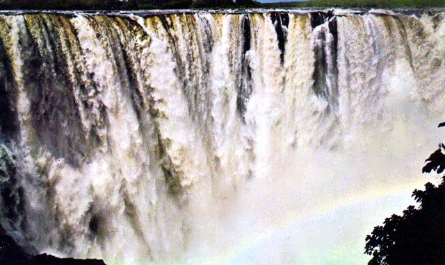
The 1860-yard crest of the Falls is divided into five separate waterfalls—the Devil's Cataract, Main Falls, Horseshoe Falls, Rainbow Falls and Eastern Cataract. The fastest- and deepest-running water goes over the Devil's Cataract, next to the Rhodesian bank. The mean height of the Falls is 304 ft. The second major curtain of water, the Rainbow Falls, is the highest (355 ft.).

When crossing from Rhodesia into Zambia the visitor must pass through full border formalities on both sides.

From the road can be seen the gap where the river continues its way below the Falls, Between Danger Point on the Rhodesian side and the less accessible opposing promontory called the Knife Edge, swirl the turbulent waters of the Boiling Pot.
Ph4-2, Victoria Falls

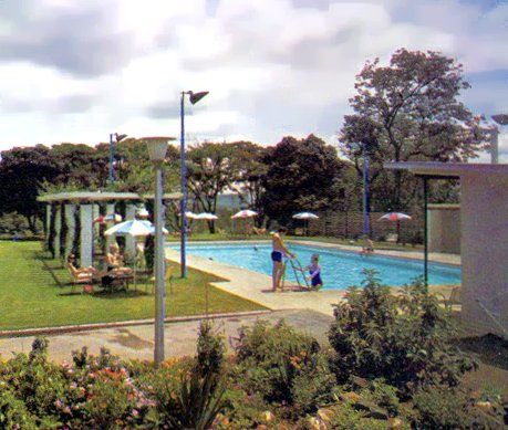
Both hotels have swimming-pools. The one at the Casino has underwater lighting and is set amongst lawns Mopane trees. The Falls Hotel has tennis courts and a refreshment kiosk alongside a pool which commands fine views of the Second and Third gorges.
Ph4-3, Victoria Falls

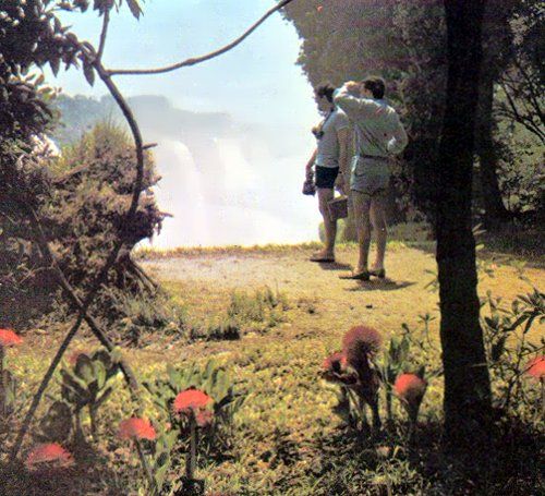
Opposite the western half of the Falls and for almost three-quarters of their length, a footpath passes through the Rain Forest, a dense tree-jungle nurtured by the incessant spray of the Falls. The floor of the Rain Forest is covered in November by masses of red Haemanthus filiflorus and the path gives access to a series of remarkable head-on views of the torrent from relatively few yards' distance.
Ph4-4, Victoria Falls

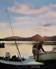
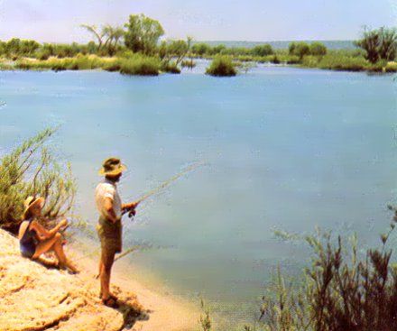
Tiger fish and bream give anglers good sport ail the year round in the Zambezi, and a licence is not required. Designated fishing-spots and a fenced fishing-camp opposite Kandahar Island have been provided along the Zambezi Drive.

Ph5-1, Victoria Falls

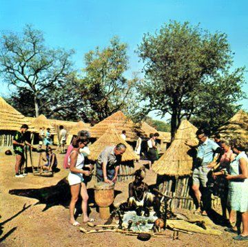
Near the hotels a replica of a 19th Century Matabele village has been created. It is open to visitors throughout the week and craftsmen can be seen making the various implement and curios which are on sale.
Ph5-3, Victoria Falls

Near the hotels a replica of a 19th Century Matabele village has been created. It is open to visitors throughout the week and craftsmen can be seen making the various implement and curios which are on sale.
Ph5-2, Victoria Falls

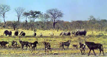
The National Park has fine herds of the national animal— the princely Sable antelope—which is relatively rare in other parts of Africa. Other animals easily seen include buffalo, kudu, water-buck, bush-buck, impala and warthog.

Ph6-1, Victoria Falls

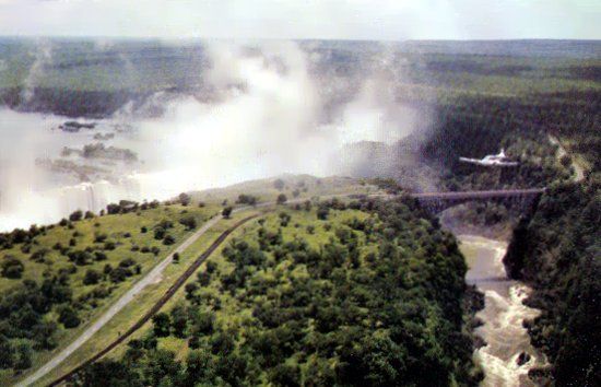
To be appreciated fully, the Falls should also be seen from the air. Several air-excursions by Rhodesia United Air Carriers are available, and reservations can be made at either of the hotels. Described by most passengers as the highlight of their visit is the Zambezi Sky Safari. This is a flight of more than 200 miles over country teeming with game. The route is westerly to Botswana, then returning along the course of the Zambezi, and culminating in several circuits over the Falls. The flight affords unique opportunities for the photographing of wild animals, very often in herds of hundreds. The 219-yard road/rail bridge was built, at the direction of Cecil Rhodes, at a point where the spray would fall upon it. It is 310 ft. above the gorge at high water.
Ph6-2, Victoria Falls

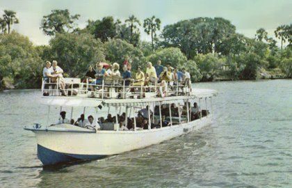
A launch trip on one of Africa's loveliest rivers for a picnic tea on Kandahar Island is a rewarding
experience. Hippo are invariably seen, and sometimes crocodile.

In the dry months of July to November, elephants and other game may be spotted on land or in the river.

The bird life is of never-ending interest. The launch operators' offices in the village arrange transport
to the landing-stages two miles up-river of the Falls.
Ph6-3, Victoria Falls

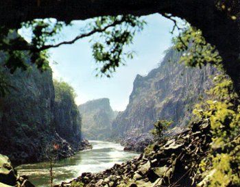
For many people the gorges through which the Zambezi flows for many miles downstream have a
fascination almost as great as that of the Falls themselves- There are eight such gorges, and good viewpoints exist for nearly all of them. Numerous walks may be taken to see the gorges. From the hotels, pathways lead to the Second and Third gorges and provide fine vantage-points. On the road from Bulawayo, and two miles before reaching the Falls village, a drive to the crest of a hill offers a panoramic view both of the gorges and the Falls,
Ph7-1, Victoria Falls

The most impressive stretch of the Falls, and certainly the most photographed, is the majestic 800-yard-wide Main Falls, which lies between Cataract Island and Livingstone Island. The usual flow of water over the whole of the Falls in April is 75 million gallons per minute and, although diminishing in October, the flow at that time is still considerable. Conditions are thus ideal for sight-seeing from the Rain Forest, for visitors do not get drenched by the spray. There are also clearer views for photography when the flow is below maximum.
Pg7-4, Victoria Falls

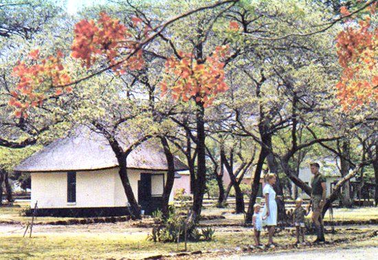
There are two well-equipped rest camps. Four miles upstream is the Zambezi Camp, which consists of 20 self-contained luxury lodges ranged along the river bank, in secluded surroundings. In the village more than 30 chalets are set amongst pleasant gardens and colourful shady trees. There is a caravan park at the chalets, and a site for camping. Only a few minutes walk away are the licensed Sprayview Restaurant and a small shopping centre. The National Parks' Reception Office contains an Information Bureau.
Ph7-3, Victoria Falls

Those requiring further information should write to:
The Warden, Victoria Falls National Park
P.O. Victoria Falls, Rhodesia.
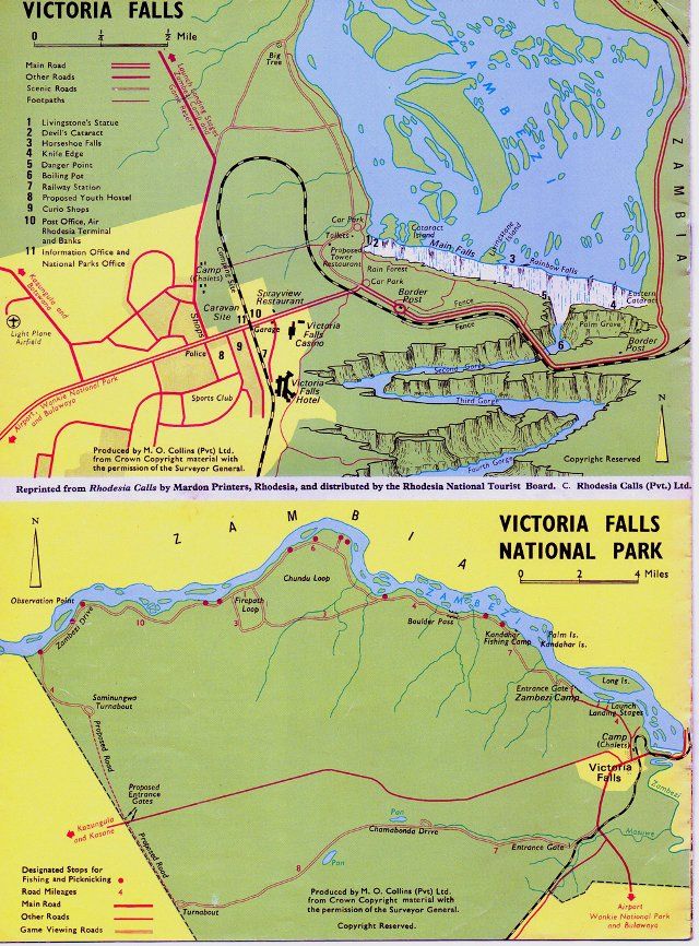

Ph8-1, Victoria Falls

Reprinted from Rhodesia Calls by Mardon Printers, Rhodesia and distributed by the National Tourist Board. C. Rhodesia Calls (Pvt) Ltd.

End

Extracted and recompiled, by Eddy Norris, from material made available by Darryl Burlin, and for use on Our Rhodesian Heritage that ORAFs administers.
Thanks to Darryl.

Comments are welcome, please enter them below or mail them to ORAFs and they will be uploaded to this article

To view the Blog Home Page - Please Click Here.
 
(Please visit our previous posts and archives)

Labels: , ,

Wednesday, 26 September 2012

Local Lingo

Found in the  Royal Air Force magazine: Slipstream  (15.10.1943) (Rhodesian Air Training Group)
Not PC but the phonetic spelling is priceless


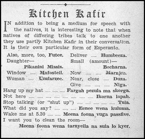
In addition to being a medium for speech with the natives, it is interesting to note that when natives of differing tribes talk to one another they use partly Kitchen Kafir in their conversation.

It is their own particular form of Esperanto.

LL1, Local Lingo or KK

Also, more, too, - Futee.
Deliver ..... Humbeeza.
Daughter - Pikanini Missis.
Small (amount) - Bechana.
Woman - Umfarzee.
Near, close - Duza.
Give - Niga.

Hang up my hat - Fargah pezula ma skorga.
Not here - Ikorna lapah.
Stop talking (or "shut up") - Tula.
What did you say? - Eenee wena kuluma.
Wake me at 5.30 ........... Meena foona vuga passfive
I want you to clean the room - Meena foona wena tarnyella na sula lo kyer.

End


Recompiled by Eddy Norris, for use on Our Rhodesian Heritage blog that ORAFs administers.
Material made available by Vic Mackenzie. Thanks Vic

Please note that ORAFs (Eddy Norris ) does not condone the "K" word that is used in this document but acknowledges that that was the way people spoke in this period of time.
No offence is meant or intended.
To view the Blog Home Page - Please Click Here.
 
(Please visit our previous posts and archives)


Tuesday, 25 September 2012

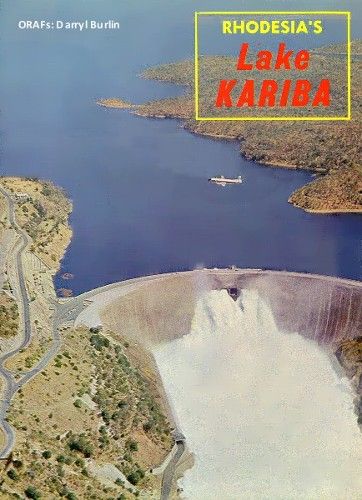
Rhodesia's Lake Kariba

Pg1-Cover, Lake Kariba

Kariba is Many Things

KARIBA is many things. To the sight-seeing tourist the giant masonry that holds back the world's largest artificial lake  is now one of Rhodesia's greatest sights, second, possibly, to the Victoria Falls; to the engineer, Kariba and its power  station is one of the world's finest technological achievements, an example of the genius of modern man; to the fisherman, the waters of Kariba are a fabulous fishing ground, especially for the much-sought-after fighting tiger; and  to the ordinary holidaymaker, Kariba is the place for a carefree holiday by the lake in hotel, motel or camp.

It should be noted that this guide is confined to the eastern end of Lake Kariba. The lake is so vast that other parts have not been included.

Pg2-1, Lake Kariba
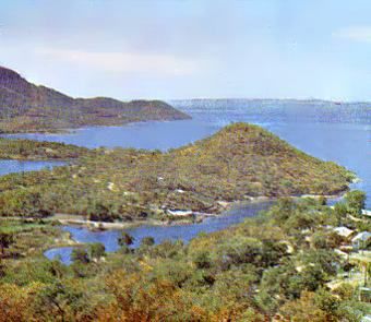
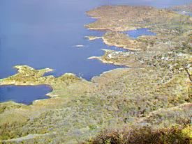
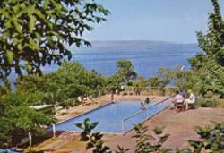
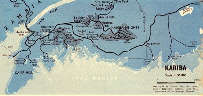
Above: A view from Camp Hill, with Lake View Motel in the foreground and the Kariba Yacht Club in the sheltered bay below.


HOW TO GET THERE
Lake Kariba can be readied by road and air.

Road; In Rhodesia the main road from Salisbury to Zambia is taken as far as Makuti, where there is a secondary road  turning off to the left, which leads to Kariba. The road from Salisbury to Makuti, a distance of 180 miles, passes  through Sinoia (72 miles) and Karoi (126 miles). From Makuti the road winds for 40 miles up to  the Kariba Airport  turnoff to the left, and continues another 10 miles to Kariba Township and another mile to the dam  wall itself. Total  distance from Salisbury to the wall—231 miles. In Zambia the shortest route is via a turnoff to the right  from the main  Kafue-Salisbury road, 11 miles north of Chirundu. The distance to the dam wall from the turnoff is 42  miles of  secondary road.

Air: Air Rhodesia, the national airline, operates scheduled air services to Kariba daily, Monday to Friday, linking it with  the country's main centres. Airline transport between the airport and resort hotels and motels is available at a nominal  charge. A wide range of all-inclusive Flame Lily holidays, most of which include a visit to Kariba, are available from the  principal centres of Rhodesia and from Malawi, South Africa, Mozambique and Mauritius. These holidays often include  a launch or game-viewing cruise on the lake.

BORDER FORMALITIES
Customs and immigration posts of Rhodesia and Zambia are situated on either side of the dam wall and are open 6  a,m. to 6 p.m. between April 1 and September 30, and 6 a,m, to 7 p,m. for the other half of the year, Rhodesian  customs and immigration authorities are on duty at the airport to deal with scheduled over border flights.

WHAT TO SEE AND DO
There is more to see and do at Kariba than viewing the wall, fishing and boating.

Wherever you are staying you will find it most rewarding to visit the resort sites. Each has its own atmosphere, outlook  and amenities, which will add variety to your stay at Kariba.

Pg2-4, Lake Kariba

Above: Blue lake, sky and distant mountains are seen from the Lake Drive, which skirts the water's edge near Kariba.


Pg 2-2, Lake KAriba
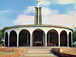
Above: The unique Roman Catholic church of St. Barbara is situated on Kariba Heights and has
many features to interest the visitor.


A tour of Kariba township, 1,200 feet high on a hill overlooking the lake, should also be made by every visitor. The township is reached by a full-width, tarred highway that winds up through the hills, affording the visitor  magnificent views over hundreds of square miles of lake scenery. Sunsets seen from this high vantage point arc truly  awe-inspiring. A visit to the Roman Catholic church of St. Barbara should certainly be made while in the township.  Built by the Italian employees of Impresit, the main contractors for Kariba, in memory of those who lost their lives while  the dam was being constructed, the unique design is perfectly suited to its surroundings. The central altar and statues  of the saints of the national groups engaged at Kariba are of especial interest.

Pg2-3, Lake Kariba
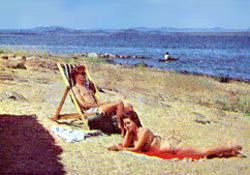
Above: Kariba is the ideal place to acquire a tan,either on this private beach at the Venture Cruises
Motel, or at the swimming pools at hotels and motels.


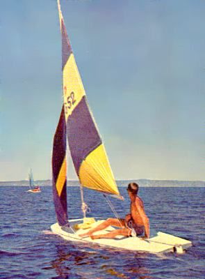
Below: Yachting is a joy on the vast waters of Lake Kariba, and regular regattas are held by the thriving Kariba Yacht Club. Visitors with their own boats arc always welcome at the club, which has a fine lakeside clubhouse. Power-boating on the lake is also allowed on the lake
Pg2-5, Lake Kariba

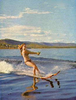
Small boats of all descriptions are on hire at most resorts for trips on the lake or for water-skiing. Instruction in this thrilling sport is also offered at several resorts. Game-viewing cruises along the eastern shore of the lake, where elephant can be seen, are also provided daily. There is also a 44-seater craft, the Djoya, which is liquor-licensed, operating cruises. A cruise across the lake and up the zig-zag Sanyati Gorge is most rewarding and provides excellent fishing.

WHEN TO VISIT KARIBA
April to September, which are the dry winter months, is the most popular visiting period, although the whole year  round the holidaymaker will find much to do and see. The hottest months are October and November, although the  fishing is particularly good in these months and lake breezes counteract the seasonal rise in humidity.

FISHING
Wherever you stay in Kariba you can hire boats, rafts or cruisers and set off" on fishing expeditions with all the advice  and assistance you require. Fishing tackle can be purchased at resorts.

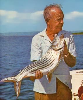
The most sought-after fish at Kariba is the tiger fish, closely followed by the tilapias or "bream" family. The latter  include the red-bellied bream (Tilapiamehnopleura), the plankton-eating bream (Tilapia macrochir), and the green bream (Sargochromis codringtoni). Other specics of fish to be found arc the chessa, n'kupi, bottlenose Cornish jack, and (in the swampy areas) the lung fish. There are also barbel, electric barbel, the giant catfish (known to Rhodesians as vundu), squeakers (an excellent tiger bait), silverfish (Labeo species) and eels.

Each year in September the Rhodesia National Anglers' Union hold an international tiger fish team tournament at Charara that attracts entries from all over southern Africa.

Pg3-1, Lake Kariba

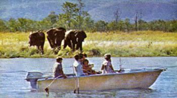
Above: Elephants on the shore at Bumi Hills. The nearby Matusadona Game Reserve has a high population of wild life, much of which can be seen at the waters edge from passing boats.

Pg3-3, Lake Kariba

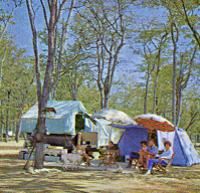
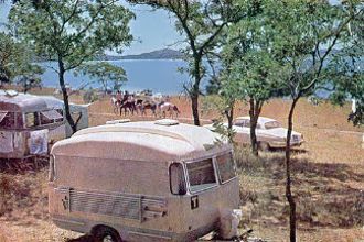
Above: A shady spot to park the caravan and camp at the Mopani Bay site, which is on the lake shore.

Pg3-4, Lake Kariba

Above: The interesting bays and inlets along the shoreline can be fully appreciated from viewpoints at Kariba Heights.

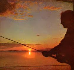
Below: A typical sunset over the lake.

Pg3-5, Lake Kariba


WALL AND LAKE
The double-curvature concrete arch dam has a maxi- mum height of 420 feet, a crest length of 2,025 feet and carries a 40-foot-wide road. It contains approximately 1,275,000 cubic yards of concrete. There are six flood gates, each 30 feet high by 31 feet wide, whose combined discharge capacity is 336,000 cusecs (2 million gallons a second).

The capacity of the lake when full is 149 million acre feet. The length from end to end is about 170 miles, the maximum width 20 miles, and the total area about 2,000 square miles.

The public are allowed on to the car park on the southern end of the dam wall where close-up views of the wall and gorge are obtainable. Permission must first, however, be obtained from the immigration officer at the border post.

Pg5-1, Lake Kariba

Tuition in the exciting sport of water-skiing is provided at several lakeside establishments.

Below: Game-viewing trips are operated daily.


Pg5-4, Lake Kariba


ACCOMMODATION AND FACILITIES
At Kariba there are two hotels, both offering air- conditioned rooms with private bathrooms: the Kariba Hotel, 1,200 feet  above the lake in the township, and the Cutty Sark, on the lake shore. Two motels, the Lake View on Camp Hill, and Venture Cruises on the lake shore, provide accommodation in an attractive setting, the Lake View particularly offering a range from air conditioned, self-contained lodges to inexpensive fishermen's huts. The hotels and motels are fully licensed and their bars and restaurants provide for the "casual'' visitor, as well as their own residents. A camping andcaravan site is situated at Mopani Bay, where, as the name suggests, the large, level site is shaded by tall trees inhabited by mopani squirrels. Harbour and mooring facilities are provided at all establishments, except the Kariba Hotel. All hotels and motels have their own swimming pools and other recreational facilities, and at one there is also a chip-and-putt golf course.

Forty miles up lake, on the southern shore, is the Bumi Hills Hotel, which is situated on a promontory 400 feet above the lake. Game can often be seen on the shore below from the hotel verandah. The hotel can be reached by air or by boat.

At the western end of the lake, reached from turnoffs from the Bulawayo-Victoria Falls road are resorts at Binga and Msuna Mouth, catering mainly for the fisherman. There are at present no scheduled boat services traversing the length of the lake, but visiters can make the 170-mile journey in their own craft. All visitors embarking on any journey on the lake, other than coastal cruises, should notify the Lake Navigation Control Office and acquaint themselves with regulations and safety procedures.

Pg5-3, Lake Kariba

Above: From the gardens of the Cutty Sark Hotel the Matusadona Mountains can be clearly seen.

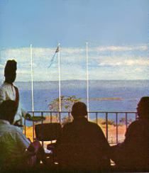
Below:  The Kariba Hotel is situated 1,200 feet above the lake, and from its terrace and bedrooms views over hundreds of square miles of lake scenery are obtainable.
Pg5-2, Lake Kariba

MATUSADONA GAME RESERVE
A cruise to Bumi Hills takes you past the Matusadona Game Reserve situated between the Sanyati and Bumi rivers. This reserve is not at present open to the public, but much game, especially  elephant, can be seen from the lake.

Pg5-5, Lake Kariba
Above:  A fine tiger fish, its huge teeth much in evidence. Such catches are not unusual and provide the sporting fisherman with a challenging fight.

FURTHER INFORMATION
Further detailed local information may be obtained from the Visitors' Bureau maintained at the Kariba Service Station  by the Lomagundi Regional Development and Publicity Association.

P6-1, Lake Kariba

Reprinted from RHODESIA CALLS by Mardon Printers, Rhodesia, and issued by the Rhodesia National Tourist Board.

End

Extracted and recompiled by Eddy Norris for use on Our Rhodesian Heritage Blog from material made available by Darryl Burlin. Thanks Darryl.

Comments are always welcome, enter direct or send them to Eddy Norris at orafs11@gmail.com and they will be uploaded accordingly.

To view the Blog Home Page - Please Click Here.
 
(Please visit our previous posts and archives)


Tuesday, 18 September 2012

Rhodesia's Kyle National Park

Pg1-Cover, Kyle's National Park

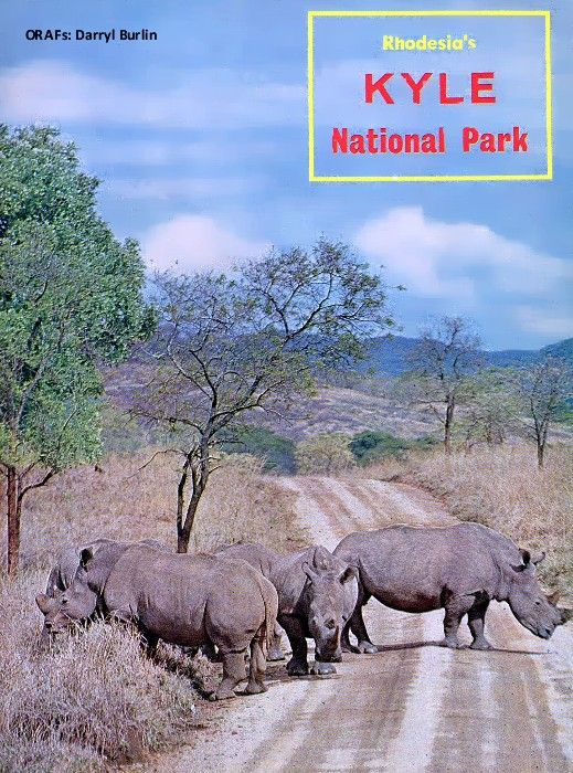
KYLE National Park, situated on the south-eastern edge of the Highveld, is one of the loveliest, of Rhodesia's many national parks. Centred on Lake Kyle, the second largest lake in the country (which was created as part of the vast irrigation complex for the Lowveld), the park offers the visitor beautiful scenery, boating and fishing, and some of the most concentrated and interesting game viewing in Rhodesia.

Pg2-1, Kyle's National Park
The roadway across the 203-fool-high dam wall leads to the scenic Murray MeDougall Drive, On the hill overlooking the wall is a small tearoom.
The sealing of the Mtilikwe River by the 200-foot-high, 1,000 foot-long Kyle dam has caused the river to flood back up the valleys of its tributaries until the lake now spreads over 35 square miles, with one of the most varied shorelines of any of Rhodesia's inland waters.

Pg2-1, Kyle's National Park
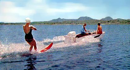
Skiing across the blue waters, with the Nyuni Mountains in the background.

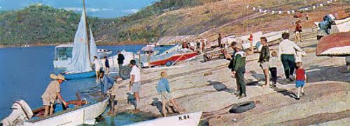
Boating on these wide expanses of water is very popular, and from the clubs situated on the southern shore, quite close to the dam wall, the bright sails of yachts and the creaming wakes of power-boats and water-skiers add colour to the  scene, Many visitors hire boats and explore the hundred-and-one picturesque bays and inlets along the 160-mile-long shoreline, or the small islands of tumbled rocks, on many of which cormorants and herons have established nesting colonies. Others take guided boat tours.

As the lake has grown, thousands of black bass fingerlings have been introduced, and these have grown so well that an international bass-fishing contest is held here each year. The largest bass caught in the lake weighed over 7 lb., but catches of up to 4 lb. are quite common. The Rhodesian bream (or more correctly Tilapia mcianopleura) is also present in large numbers. Moreover, fishing can be enjoyed the whole year round.

Pg2-4, Kyle's National Park
Fishing for bass can be enjoyed all year round at Kyle. The record bass caught weighed 7 lb., but catches of 4 lb. arc quite common. Licences are available from the Kyle and Zimbabwe National Parks' offices

The park is best known, however. for its 20,000-acre game reserve situated on the lake's northern shore. There are over 30 rare White, or square-lipped, rhino in this reserve, and they can often be seen in groups of six or seven. The good  conditions under which the animals live have favoured a high breeding rate, and the young of most species in the reserve can be seen, the young rhino calves being a firm favourite among visitors.

Another attractive feature of this reserve is the great variety of antelope to be seen—more species than in any other single national park including the very rare oribi. Lichtenstein's hartebeeste, blesbok and nyala. Along the 40 miles of gravel roads that traverse the reserve motorists have a wonderful opportunity to see an abundance of wild life at close quarters. The reserve is open the whole year round, although in extremely wet  weather some of the roads may be closed.

Pg2-3, Kyle's National Park

Kyle Game Reserve is the home of some of Rhodesia's rarer types of antelope, Nyala (Above), Tssessebe (Below), oribi. blesbok and Liehtenslein's hartebeeste. seldom seen in other national parks, can be approached quite closely by visitors iri their cars.

Pg3-1, Kyle's National Park

Below. Within the game revive, these lodges provide complete facilities for the holidaymaker. including a servant. Visitors need only bring their food..
Pg3-3, Kyle's National Park

Pg3-2, Kyle's National Park
Above. On the southern side of the lake, at the thriving Kyle Boat Club, regular regattas and power-boat races are held. Visitors are always welcome, but all craft must he registered withi the Warden.

Pg3-4, Kyle's National Park
Above. Around the lake and on the numerous islands is a prolific bird lite, white in the reserve the world's largest bird, the ostrich, can be seen.

Pg4-1, Kyle's National Park

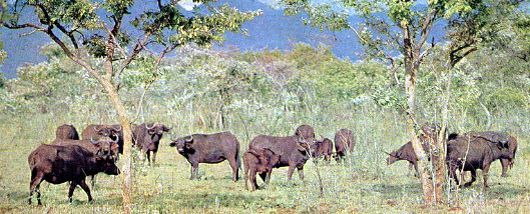
Above. As well as the rarer types of antelope and the While rhino, the reserve has good populations of Buffalo, Eland, Sable, Zebra, Kudu, Waterbuck, Impala, Wildebeeste and Reedbuck.


Below. There are attractive caravan parks, both on the southern shore of the lake and within the game reserve itself.

Pg4-2, Kyle's National Park

Below. Evening light, adds to the beauty of this lake land national park.
Pg4-3, Kyle's National Park

Within the game reserve itself is a rest camp which can only be described as "luxury in the bundu".
Built on a hill overlooking the lake, six two-bed and three four- bed lodges rise in terraces in the shade of Msasa trees. These are fully furnished, including a gas cooker, refrigerator, crockery, cutlery, pots and pans, bed linen, blankets and towels. A servant is provided. On a nearby hill is a caravan and camping site, which also enjoys a beautiful view of the lake.

Wherever one is at Kyle, whether on the lake or in the reserve, there is always a background of lovely scenery. To the west, bordering the reserve, rise the soft outlines of the Beza Range, while to the east the more dramatic peaks of the Nyuni Mountains rise, thickly wooded to their summits, like colossal draperies.

A favourite scenic road is the Murray McDougall Drive, named after one of the pioneers of the Lowveld development. It runs from the dam walk skirting the western shores of the lake and passing under the shadow of the Nyuni Mountains untill it joins the main Fort Victoria-Birchenough Bridge road 17 miles east of Fort Victoria. For visitors staying in the rest camp at the reserve the journey can be made in the opposite direction, with a break  at the Zimbabwe Ruins for tea or lunch.

HOW TO GET THERE
The nearest town to Kyle National Park is Fort Victoria, which is 178 miles south of Salisbury and 179 mites north-east of Bulawayo. Access to the northern shore of the lake, where the game reserve and rest camp is situated, is gained from a turn-off eight miles east of Fort Victoria on the road to Birchenough Bridge. From this turn-off a well-maintained gravel road leads for 12 miles to the rest camp, passing through part of the game reserve. The  southern shore, where there is chalet and camping accommodation and caravan parks, and where the boat clubs and dam wall are to be found, is 24 miles south of Fort Victoria, on the road that passes through the Zimbabwe National Park, There are hotels at Fort Victoria, Zimbabwe and just off the Murray McDougall Drive in the Nyuni Mountains.

Reprinted from "Rhodesia Calls" by Unitas Press, Rhodesia, and issued by the Rhodesia National Tourist Board.

End

Extracted and recompiled by Eddy Norris from material made available by Darryl Burlin. Thanks Darryl.

Comments are always welcome, send them to Eddy Norris at orafs11@gmail.com

To view the Blog Home Page - Please Click Here.
 
(Please visit our previous posts and archives)