Khami Ruins
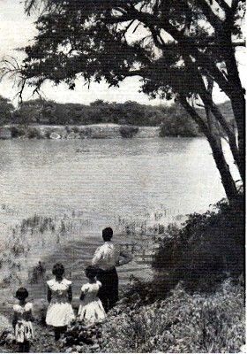
Looking across part of the Khami Dam towards the
PRECIPICE RUIN, partly submerged by the waters of the Dam.
KHAMI is now an oasis in a very dry part of Matabeleland because the Bulawayo City Council sited its first storage reservoir there to impound the waters of the Khami River. The concrete wall dams up a narrow gorge, forming a lake which holds over 700,000,000 gallons of water.
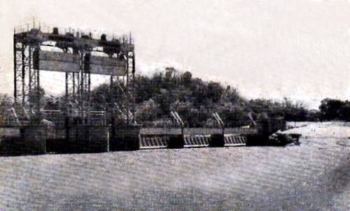
The Dam Wall and Flood Gates.
Access to the Dam is by means of a footpath behind the Passage Ruin.
Despite the apparent dryness and infertility of the surrounding veld, the area has a long history of human occupation. Excavations undertaken at the Waterworks site under the aegis of the Historical Monuments Commission disclosed in a sheltered glade, an almost unbroken occupation of some 40,000 years. The first Primitive humans left behind them hand-axes and other weapons made of stone. These were located on the granite bedrock some six feet below the present surface. In the decomposed granite sand which had accumulated above bedrock approximately 250,000 artefacts made of stone were recovered. Some of these stones were not available locally but had to be carried by hand from sites located as much as 40 miles down stream. Above the sands were three Iron Age occupation levels containing the debris of the inhabitants. The final phase, which included the remains of the ubiquitous paraffin tin, was an African village which was occupied until 1928.
The Stone Age nomadic hunters must have found this an excellent hunting area, with water and shelter ample for their requirements. Game and fruits must have been available for eating. The people were food gatherers, relying on the natural products of the soil, and not food producers.
The people living in the final phases of the Stone Age were responsible for the " Bushman Paintings.'4 Some examples can be found on rocks and in shelters amongst the granite kopjes not far from the dam area.
The Late Stone Age people lived peacefully and undisturbed for a long period, but raiding parties of Iron Age people eventually disturbed the simple life of these nomadic hunters.
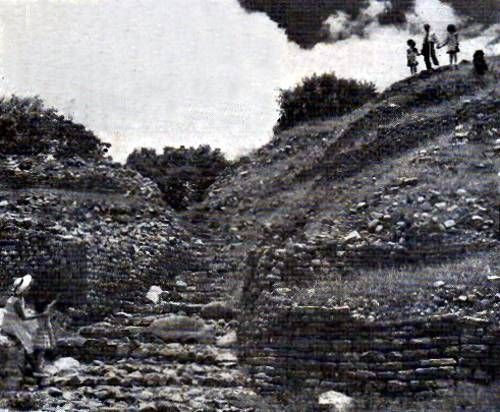
MAIN ENTRANCE, HILL RUINS. These ruins are sited on rocky
heights running parallel to the Khami River and overlooking the Gorge.
The first Iron Age people, who were probably Negroid, did not displace the earlier inhabitants, but possibly settled in small bands living and interbreeding with them. Later, larger influxes of men and animals amplified the need for agricultural and grazing land. This caused the displacement of the Late Stone Age People, similar to the modern Bushmen, who today can only be found in a few isolated parts of Southern Africa. The occupation levels show that the Iron Age people not only brought iron into the area, but the art of pottery making as well. Glass beads of various colours made their appearance at this time. Although primitive in many ways, the pottery shows great variety of shape and simple decoration. The beads indicate that the invaders were in touch, albeit remotely, with the coastal trade from the Far East. These people cleared the lands of stone, formed rough walls, built huts of pole and dagga, smelted iron and knew the uses of copper.
HILL RUIN No. 3. The decorated wall is seventy feet in length, fine feet high.
They also appear to have had a settled existence for many years, but in turn were also disturbed by movements of other tribes. It was these later people who were responsible for constructing the stone buildings which we now call "Khami Ruins."
On very good grounds it is thought that the people responsible for the type of buildings at Khami were of the Rozwi Tribe. These people dominated the local Kalanga tribesmen, using them as labourers under direction for dressing the stone and building the walls. At Zimbabwe similar walling has been dated between 200 and 400 years ago. This date was established by the CI4 radio-active carbon method.
The stone wall builders had a more advanced form of living than the earlier people, having better huts and more possession. Not only had they very highly decorated and well made pottery, but they had mastered the art of spinning wild cotton with the use of spindle whorls made of pottery or soapstone. By the 18th century trade had increased as is known by the discovery in later excavations of some beads and other articles which were not manufactured in Africa.
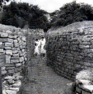
THE CHEQUER PATTERNED WALL at the Hill Ruin.
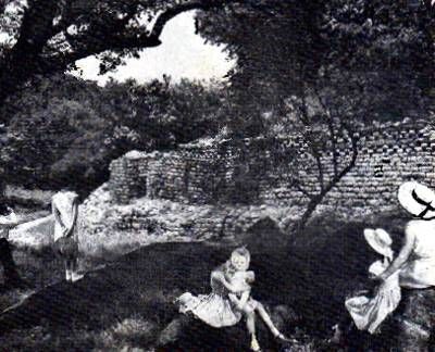
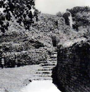
THE PASSAGE RUIN, the first within the ruins area, is
situated 200 yards from the road, on the right hand side.
situated 200 yards from the road, on the right hand side.
Chinese porcelain is not uncommon, and this would have found its way from China across to Zanzibar and the adjacent African coast. Trade by dhows is still being carried on . These small boats travel with the Monsoon wind, and arrive in Africa at the same point on every journey at approximately the same time of the year. The dhows rest until the winds are favourable and then complete the return trip. Undoubtedly this trade was carried on for many centuries and must have accounted for most of the early imports Into Africa from the Far East.
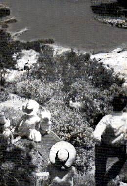
Looking down from the HILL RUIN into the
CROCODILE POOL. Khami Gorge, below the
dam wall.
CROCODILE POOL. Khami Gorge, below the
dam wall.
Although there is no evidence to suggest that the stone wall builders were iron smiths, they had a large number of iron tools and weapons.
Trade was carried out with the indigenous tribes. Local tradition has it that one iron hoe was exchanged for one beast. Until approximately 1800 A.D. the ruins were inhabited, but the raiding Swazi impis from the South disrupted the Mambo dynasty, sacking Khami and dispersing the people in many directions.
A site Museum will be completed during 1966. Guide books will then be obtainable at the Ruins. They can now be obtained from all book sellers and from the Historical Monuments Commission, suite 712 York House, 8th Avenue, Bulawayo.
HOW TO GET THERE
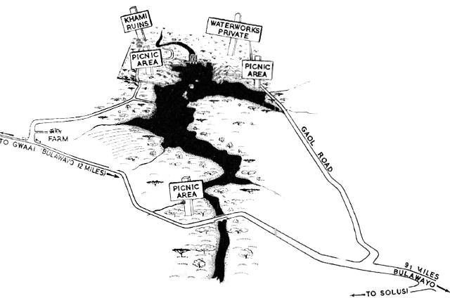
The Khami Ruins are situated 13 miles west of Bulawayo on the Khami River. Leave Bulawayo by 11th Avenue, which passes through part of the Industrial sites, and then becomes the Khami road. Follow this road for 12 miles to the gateway of Green Gables Farm, just before the tarred road finishes. Turn right through this gateway, and the road leads directly to the ruins, which cover an urea of approximately 2 square miles. The road to Khami Dam picnic sites turns off the main road 9½ miles from Bulawayo.
The following advertisements were included in this brochure.
End
Extracted from a brochure made available by Lewis Walter. Extract, and recompiled by Eddy Norris for use on "Our Rhodesian Heritage" blog.
COmments are welcome, send them to orafs11@gmail.com


0 Comments:
Post a Comment
Subscribe to Post Comments [Atom]
<< Home