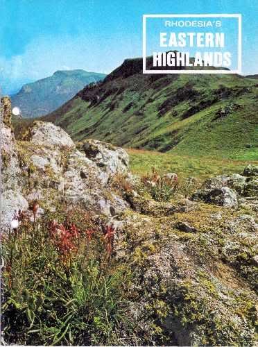
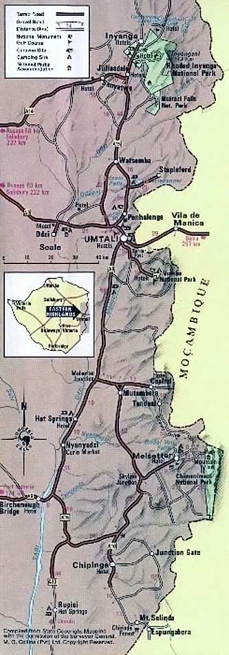
FOR 300 kilometres. Rhodesia's eastern border with Mozambique is dominated by a series of dramatic and beautiful mountain ranges. They are a formidable natural barrier, and constitute a region that has a unique scenic character. Their names were given to them centuries ago, and they sound like an echoing African rhythm: Inyanga, Umtali, Vumba and Chimanimani.
Here the visitor may fish for trout in lakes and streams, ramble through dark forests, visit spectacular waterfalls and feel revived by the crisp mountain air.
The variety of scenery is almost infinite, from Rhodesia's highest mountain to deep gorges, from bare granite peaks to slopes richly clothed with forest growth, and from gentle downs to precipitous cliffs.
There is more to the Eastern Highlands than the spectacular scenery, however, for the flora to be found here Is diverse, and in many eases unique. At Inyanga the visitor will find the Inyanga aloe (A. inyongensis) growing only on the highest peaks, and the dwarf msasa forests found only on westward facing slopes. In the Vumba there are the extensive gardens of the national park, while in the Chimanimani Mountains tree and ground orchids are only two examples of a unique range. Further south In the Chirinda Forest are the giant red mahogany trees which are Rhodesia's largest form of plant life.
Wild life is also present in these unspoiled, lightly populated areas. Although not found in such numbers as in one of the many game reserves, duikers, bushbuck. the rare samango monkey, eland and sable are frequently seen. The bird life Is particularly prolific, for the forests and open heathland provides habitat for a great number of species. Eagles and other birds of prey are commonly seen.
Each area has its own character and attractions for the visitor, and the following pages, which deal with each In turn, provide a glimpse of some of the reality of the richness of Rhodesia's Eastern Highlands.
INYANGA Mountains
This impressive range forms the northern end of Rhodesia's Eastern Highlands. Reached by scenic highways, the area is a never-ceasing favourite with Rhodesians and visitors to the country. Here the eye moves naturally to the horizon-wide vistas of mountain, green forest and plain, and the clear air encourages even the least energetic visitor to stroll along winding footpaths and through fragrant pine woods. Man lived here long, long ago and over hundreds of square kilometres of Inyanga are the ruins marking an occupation that began 2 000 years ago. In more recent times, Cecil Rhodes visited this fresh, upland area, and purchased a large estate which was bequeathed to the nation on his death. Part of this estate became the Rhodes Inyanga National Park.
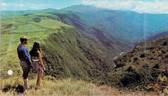
The densely wooded Pungwe Gorge, a spectacular view on one of Inyanga's scenic drives.
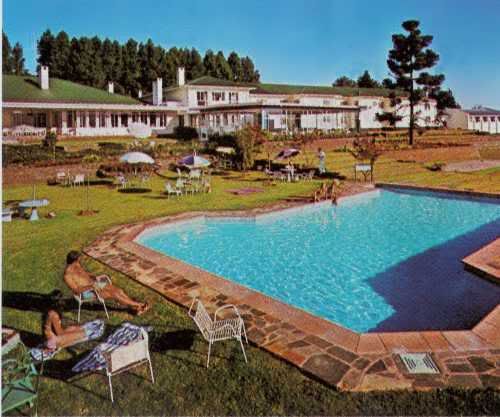
Inyanga offers the visitor a wide choice of hotels and cottage accommodation.
Several hotels offer full conference facilities. Above is the luxury Montclair Hotel,
at Juliasdale, which has its own golf course and trout-stocked lake.
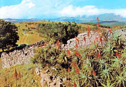
The Nyangwe Fort, its grey stone enlivened by bright aloes, is one of Inyanga's
many ancient fortified sites that may be conveniently visited. Beyond,
Mt. Inyangani, Rhodesia's highest mountain (2 593 metres) hides its head in
the clouds.
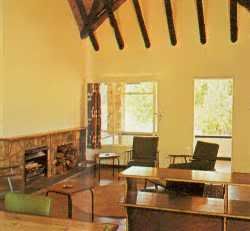
National park lodges (left), cottages and chalets may be rented by visitors.
These are situated near trout lakes, waterfalls and scenic views, such as
the accommodation (below) set among shady pines on the shores of
the Mare Dam.
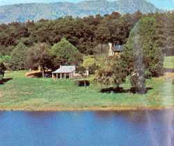
Mare Dam (refer to above photo.)
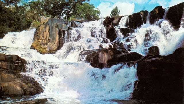
The Inyangombe Falls is just one of the many spectacular cataracts in the Inyanga area.
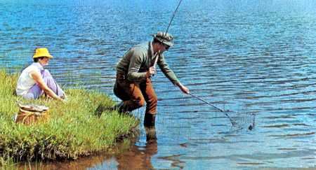
Within the Rhodes Inyanga National Park the streams and lakes
are stocked with trout (rainbow, brook and a local hybrid, tiger).
There are also private waters which may be fished, and the
Montclair and Troutbeck hotels have their own well-stocked lakes.
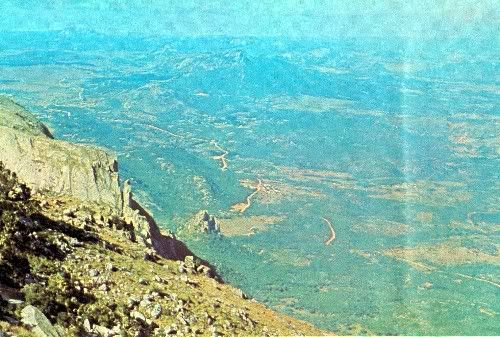
The elevation of the Inyanga area varies from 1 800 metres to 2 500 metres
above sea level.From roads that wind among the ranges, spectacular views
over the surrounding low country are obtained. One of the best-known
viewpoints is World's View (above).
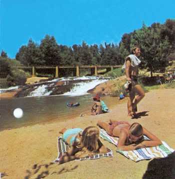
In Inyanga's clear streams and rivers, bathing is completely
safe.
At the picturesque Inyangombe swimming pool the sandy
beach is ideal for children, and change rooms are provided.
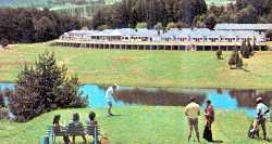
Troutbeck Inn is set high in the mountains
on the shores of its private trout lake. Its
amenities include golf, bowls and trekking
on horseback.
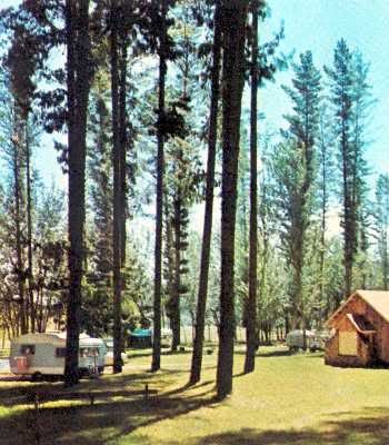
Within the Rhodes Inyanga National Park are caravan parks
and camping sites, such as the Mare Caravan Park, pictured here.
Advance booking for Christmas, Easter, and Rhodes and Founders
holidays is essential, and is recommended for holidays at any other
time of the year.
UMTALI
The City 0f Umtali in the centre of the Eastern Highlands, is the country's eastern gateway and the capital of Manicaland.
Situated amongst steep, wooded hills, and attractively laid out with wide, tree-lined streets, it lays a strong claim to be Rhodesia's most beautiful city!
For the visitor, it provides ample, well-developed amenities, many features of interest and a warm welcome. The crossroads of a first-class highway system linking the different areas of the Eastern Highlands with the rest of Rhodesia, it is also a convenient centre from which to visit the Vumba Inyanga and Chimanimani mountains.
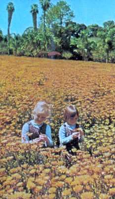
A sea of Namaqualand daisies in
Umtali's municipal park.
The city also has one of
the country's largest aloe gardens.
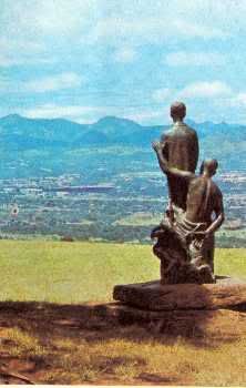
The statue of Kingsley Fairbridge as a boy,
set within a garden at the crest of
Christmas Pass.
This is a favourite viewpoint for visitors.
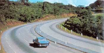
The motoring visitor will find that throughout the
Eastern Highlands wide, modern highways enable him
to travel swiftly and safely between main centres.
Here the Christmas Pass road takes the motorist
over the hills to the west of Umtali.
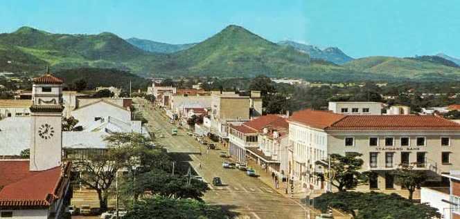
The attractive, mountain-ringed city of Umtali offers the traveller a full range of hotels and two caravan parks — a municipal park on Christmas Pass and Fiesta Park 3 km from the city on the road to the border post. Shopping facilities are good, and locally made leather and skin goods are of a high quality.
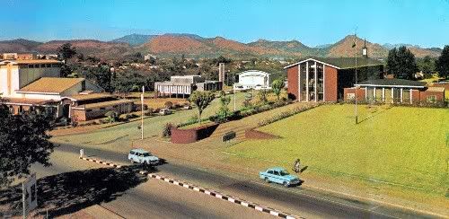
Umtali's modern civic centre includes (from left to right) the Courtauld Theatre,
the Turner Memorial Library, the Queen's Hall and the municipal offices.
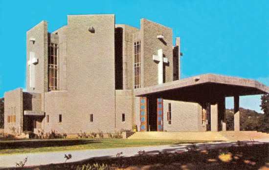
One of the outstanding examples of modern architecture in Umtali is the Roman
Catholic Cathedral, in the centre of the city.
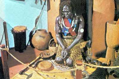
In Umtali's museum, vivid displays show life in Manicaland
in prehistoric and historic times. There are also galleries
devoted to transport (with early carriages and trains) and
the Boultbee collection of weapons.
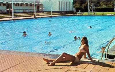
Most hotels in the Eastern Highlands number a swimming pool
among their amenities, and in Umtali there is an Olympic- size
public pool.
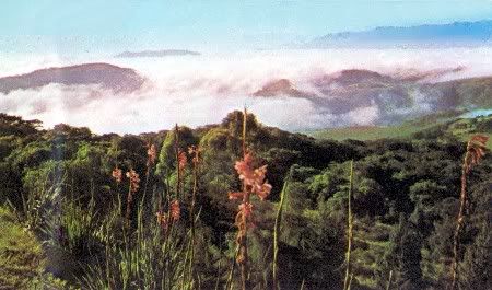
"Vumba" means mist, and in the early morning the dark mountain peaks
seem surrounded by a white sea — soon to be dissipated by the warmth
of the rising sun.
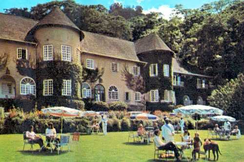
Leopard Rock Hotel, one of four picturesque hotels in the Vumba area. Holiday
cottages are also available.
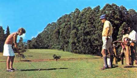
There is an interesting and scenic nine-hole golf course at Leopard Rock Hotel.
The course is open to non-residents.
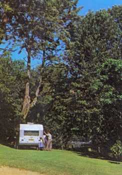
Within the Vumba National Park is a
shady caravan park and camping site
with a swimming pool. Caravaner's should
be aware of the very steep approach roads
to the park.
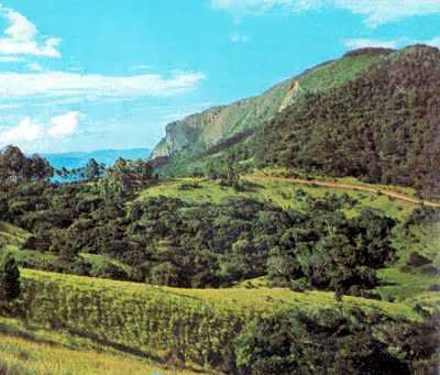
The drive up into the mountains from Umtali provides the visitor
with extensive views, westward into Rhodesia and eastward into
Mozambique.
VUMBA Mountains
A few kilometres outside Umtali, the road to the Vumba starts its scenic climb, winding through steep, tree-clad mountains and rolling farmland. At each turn, new vistas over the surrounding countryside are revealed, becoming more dramatic as the summit is approached. Twenty-nine kilometres from Umtali, after passing through the dense Bunga Forest National Park, the colourful gardens of the Vumba National Park are reached.
Here the visitor will find his attention divided between the indigenous and exotic flora that surrounds him, and the views to the east over the Mozambique plain, almost a thousand metres below.
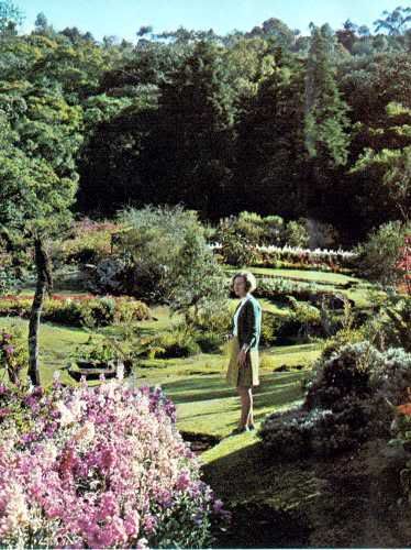
The Vumba National Park comprises 30 hectares of landscaped
garden set within a larger area of natural woodland on the eastern slopes
of the mountains. The annual displays of azaleas, fuchsias and hydrangeas
are particularly beautiful, but proteas, roses, gardenias, begonias, dahlias,
marigolds, stocks and antirrhinums provide colour throughout the year.
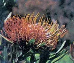
Leucospermum saxosum, a colourful
plant which also grows wild in the
Chimanimani Mountains.
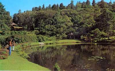
In the centre of the developed area of the Vumba
National Park is this small lake, fed by numerous small
mountain streamlets, which also form small waterfalls
among the beds of plants.
CHIMANIMANI Mountains
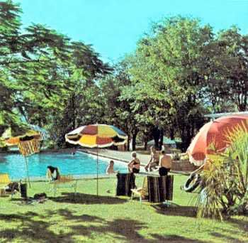
The resort of Hot Springs, on the main road 82 kilometres
south of Umtali, has been created around a natural
thermal spring which is fed into a series of swimming
pools. There are also thermal springs at Rupisi,
in the extreme south of the Eastern Highlands.
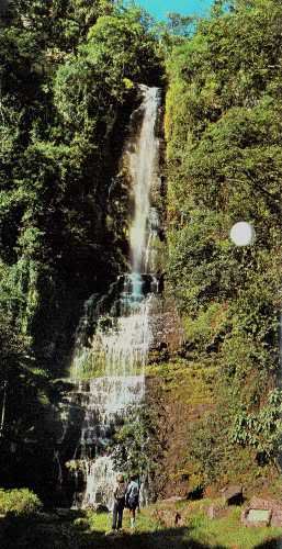
The 50-metre-high Bridal Veil Falls
are situated within a pleasant five- kilometre
walk, or drive, of the village at Melsetter.
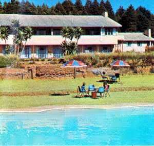
Facing the mountain range at Melsetteris the
32-room Chimanimani Hotel.
There is also a caravan and camping site with
limited facilities just outside the village.
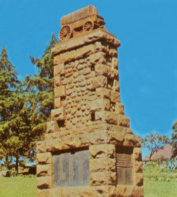
On this village green at Melsetter is the appropriate
memorial to the pioneer treks to the area in the 1890s.
The main stone is of local origin and the inset boulders
are from the Sabi River where the old ox-wagons crossed.
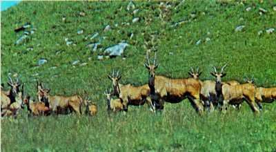
On the northern edge of Melsetter village is an eland sanctuary,
where a large herd of these animals, the largest of the antelope,
may be seen.
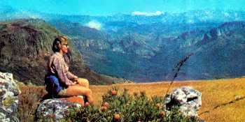
For the energetic and experienced there is a challenge in traversing
the mountains themselves. A mountain hut provides dormitory
accommodation, and camping is permitted anywhere within the
Chimanimani National Park, at the camper's own risk. Persons
walking in the mountains should notify their hotel or the
attendant at the hut of their route and expected time of return.
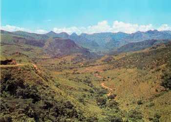
One of the most beautiful scenic drives in the Eastern
Highlands is the 64-kilometre gravel road between the
small centre of Cashel and Melsetter.
The road is generally well maintained, but local confirmation
of the condition should be obtained.
At Cashel there is an hotel — Black Mountain Inn —
with a number of outdoor amenities.
CHIPINGA
The southernmost centre in the Eastern Highlands, Chipinga was established in 1893 by members of the Moodie Trek, the first pioneers to this part of Rhodesia. Today it is the nucleus of a thriving agricultural community famous for its cheese, tea and coffee. With its lush farmlands and plantations, the Chirinda Forest and ancient ruins, the Chipinga area has much to offer the visitor.
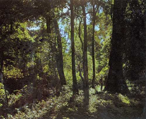
Thirty kilometres south of the town of Chipinga is the Chirinda Forest, 30 square
kilometres of primeval forest, one of the last remaining areas in Central Africa.
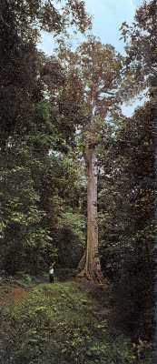
The Big Tree, the tallest tree in
Rhodesia (below), a red mahogany
over 60 metres high, may be seen
in the Chirindi Forest .
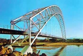
The road to the Eastern Highlands from Fort Victoria takes
the visitor over the 304-metre-span Birchenough Bridge
across the Sabi River 55 kilometres from the small southern
centre of Chipinga.
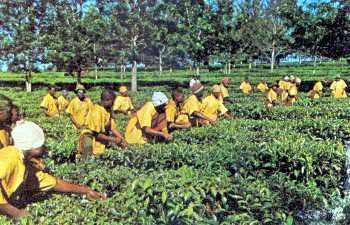
Much of Rhodesia's high-grade tea is grown in the Chipinga
area.The plantations are easily identified by the deep rich green
of the tea bushes often enlivened by the yellow clothing of the
lines of pickers.
End of Article
Recompiled, by Eddy Norris, from a copy of the booklet made available by Diarmid Smith. Thanks Diarmid
Booklet was Reprinted from Rhodesia Calls by Mardon Printers & distributed by the Rhodesia National Tourist Board
© Rhodesia Calls (Pvt.) Ltd.
The recompilation was done for no or intended financial gain but rather to record the memories of Rhodesia.
Thanks to
Paul Norris for the ISP sponsorship.
Paul Mroz for the image hosting sponsorship.
Robb Ellis for his assistance.
Should you wish to contact Eddy Norris please mail him on orafs11@gmail.com
In times past the mountains were a place of refuge for African tribes, under pressure from invading peoples, and they have left their ruined settlements and forts as evidence of their long occupation. Today these mountains fulfil a happier role, for they are one of Rhodesia's principal holiday areas and playgrounds.
Here the visitor may fish for trout in lakes and streams, ramble through dark forests, visit spectacular waterfalls and feel revived by the crisp mountain air.
The variety of scenery is almost infinite, from Rhodesia's highest mountain to deep gorges, from bare granite peaks to slopes richly clothed with forest growth, and from gentle downs to precipitous cliffs.
There is more to the Eastern Highlands than the spectacular scenery, however, for the flora to be found here Is diverse, and in many eases unique. At Inyanga the visitor will find the Inyanga aloe (A. inyongensis) growing only on the highest peaks, and the dwarf msasa forests found only on westward facing slopes. In the Vumba there are the extensive gardens of the national park, while in the Chimanimani Mountains tree and ground orchids are only two examples of a unique range. Further south In the Chirinda Forest are the giant red mahogany trees which are Rhodesia's largest form of plant life.
Wild life is also present in these unspoiled, lightly populated areas. Although not found in such numbers as in one of the many game reserves, duikers, bushbuck. the rare samango monkey, eland and sable are frequently seen. The bird life Is particularly prolific, for the forests and open heathland provides habitat for a great number of species. Eagles and other birds of prey are commonly seen.
Each area has its own character and attractions for the visitor, and the following pages, which deal with each In turn, provide a glimpse of some of the reality of the richness of Rhodesia's Eastern Highlands.

INYANGA Mountains
This impressive range forms the northern end of Rhodesia's Eastern Highlands. Reached by scenic highways, the area is a never-ceasing favourite with Rhodesians and visitors to the country. Here the eye moves naturally to the horizon-wide vistas of mountain, green forest and plain, and the clear air encourages even the least energetic visitor to stroll along winding footpaths and through fragrant pine woods. Man lived here long, long ago and over hundreds of square kilometres of Inyanga are the ruins marking an occupation that began 2 000 years ago. In more recent times, Cecil Rhodes visited this fresh, upland area, and purchased a large estate which was bequeathed to the nation on his death. Part of this estate became the Rhodes Inyanga National Park.

The densely wooded Pungwe Gorge, a spectacular view on one of Inyanga's scenic drives.

Inyanga offers the visitor a wide choice of hotels and cottage accommodation.
Several hotels offer full conference facilities. Above is the luxury Montclair Hotel,
at Juliasdale, which has its own golf course and trout-stocked lake.

The Nyangwe Fort, its grey stone enlivened by bright aloes, is one of Inyanga's
many ancient fortified sites that may be conveniently visited. Beyond,
Mt. Inyangani, Rhodesia's highest mountain (2 593 metres) hides its head in
the clouds.

National park lodges (left), cottages and chalets may be rented by visitors.
These are situated near trout lakes, waterfalls and scenic views, such as
the accommodation (below) set among shady pines on the shores of
the Mare Dam.

Mare Dam (refer to above photo.)

The Inyangombe Falls is just one of the many spectacular cataracts in the Inyanga area.

Within the Rhodes Inyanga National Park the streams and lakes
are stocked with trout (rainbow, brook and a local hybrid, tiger).
There are also private waters which may be fished, and the
Montclair and Troutbeck hotels have their own well-stocked lakes.

The elevation of the Inyanga area varies from 1 800 metres to 2 500 metres
above sea level.From roads that wind among the ranges, spectacular views
over the surrounding low country are obtained. One of the best-known
viewpoints is World's View (above).

In Inyanga's clear streams and rivers, bathing is completely
safe.
At the picturesque Inyangombe swimming pool the sandy
beach is ideal for children, and change rooms are provided.

Troutbeck Inn is set high in the mountains
on the shores of its private trout lake. Its
amenities include golf, bowls and trekking
on horseback.

Within the Rhodes Inyanga National Park are caravan parks
and camping sites, such as the Mare Caravan Park, pictured here.
Advance booking for Christmas, Easter, and Rhodes and Founders
holidays is essential, and is recommended for holidays at any other
time of the year.
UMTALI
The City 0f Umtali in the centre of the Eastern Highlands, is the country's eastern gateway and the capital of Manicaland.
Situated amongst steep, wooded hills, and attractively laid out with wide, tree-lined streets, it lays a strong claim to be Rhodesia's most beautiful city!
For the visitor, it provides ample, well-developed amenities, many features of interest and a warm welcome. The crossroads of a first-class highway system linking the different areas of the Eastern Highlands with the rest of Rhodesia, it is also a convenient centre from which to visit the Vumba Inyanga and Chimanimani mountains.

A sea of Namaqualand daisies in
Umtali's municipal park.
The city also has one of
the country's largest aloe gardens.

The statue of Kingsley Fairbridge as a boy,
set within a garden at the crest of
Christmas Pass.
This is a favourite viewpoint for visitors.

The motoring visitor will find that throughout the
Eastern Highlands wide, modern highways enable him
to travel swiftly and safely between main centres.
Here the Christmas Pass road takes the motorist
over the hills to the west of Umtali.

The attractive, mountain-ringed city of Umtali offers the traveller a full range of hotels and two caravan parks — a municipal park on Christmas Pass and Fiesta Park 3 km from the city on the road to the border post. Shopping facilities are good, and locally made leather and skin goods are of a high quality.

Umtali's modern civic centre includes (from left to right) the Courtauld Theatre,
the Turner Memorial Library, the Queen's Hall and the municipal offices.

One of the outstanding examples of modern architecture in Umtali is the Roman
Catholic Cathedral, in the centre of the city.

In Umtali's museum, vivid displays show life in Manicaland
in prehistoric and historic times. There are also galleries
devoted to transport (with early carriages and trains) and
the Boultbee collection of weapons.

Most hotels in the Eastern Highlands number a swimming pool
among their amenities, and in Umtali there is an Olympic- size
public pool.

"Vumba" means mist, and in the early morning the dark mountain peaks
seem surrounded by a white sea — soon to be dissipated by the warmth
of the rising sun.

Leopard Rock Hotel, one of four picturesque hotels in the Vumba area. Holiday
cottages are also available.

There is an interesting and scenic nine-hole golf course at Leopard Rock Hotel.
The course is open to non-residents.

Within the Vumba National Park is a
shady caravan park and camping site
with a swimming pool. Caravaner's should
be aware of the very steep approach roads
to the park.

The drive up into the mountains from Umtali provides the visitor
with extensive views, westward into Rhodesia and eastward into
Mozambique.
VUMBA Mountains
A few kilometres outside Umtali, the road to the Vumba starts its scenic climb, winding through steep, tree-clad mountains and rolling farmland. At each turn, new vistas over the surrounding countryside are revealed, becoming more dramatic as the summit is approached. Twenty-nine kilometres from Umtali, after passing through the dense Bunga Forest National Park, the colourful gardens of the Vumba National Park are reached.
Here the visitor will find his attention divided between the indigenous and exotic flora that surrounds him, and the views to the east over the Mozambique plain, almost a thousand metres below.

The Vumba National Park comprises 30 hectares of landscaped
garden set within a larger area of natural woodland on the eastern slopes
of the mountains. The annual displays of azaleas, fuchsias and hydrangeas
are particularly beautiful, but proteas, roses, gardenias, begonias, dahlias,
marigolds, stocks and antirrhinums provide colour throughout the year.

Leucospermum saxosum, a colourful
plant which also grows wild in the
Chimanimani Mountains.

In the centre of the developed area of the Vumba
National Park is this small lake, fed by numerous small
mountain streamlets, which also form small waterfalls
among the beds of plants.
CHIMANIMANI Mountains
These are the most dramatic mountains in Rhodesia, their rocky peaks reaching heights of over 2 400 metres. Among these mountains, declared a national park, are valleys inhabited only by an occasional herd of antelope, where the silence is broken by the rushing of waterfalls fed by mountain streams. This is a region of unspoiled and uncrowded natural beauty, accessible only to the hiker or climber who is prepared to carry his provisions and equipment on his back. For the less energetic, the small centres of Melsetter and Cashel are comfortable bases from which the visitor may enjoy, on scenic drives, the prospect of the mountains from below as they rise towards the border with Mozambique. These roads pass through forests of green pines and flowering wattle. Within easy driving distance of the mountains is the complete contrast of the sub-tropical Sabi Valley.
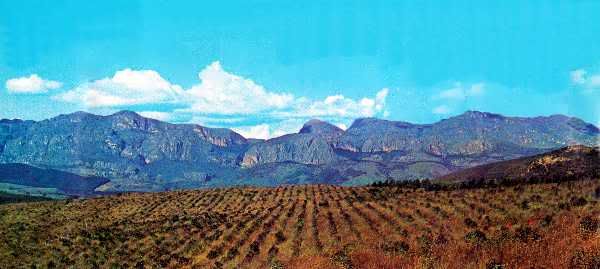
Chimanimani Mountains

Chimanimani Mountains

The resort of Hot Springs, on the main road 82 kilometres
south of Umtali, has been created around a natural
thermal spring which is fed into a series of swimming
pools. There are also thermal springs at Rupisi,
in the extreme south of the Eastern Highlands.

The 50-metre-high Bridal Veil Falls
are situated within a pleasant five- kilometre
walk, or drive, of the village at Melsetter.

Facing the mountain range at Melsetteris the
32-room Chimanimani Hotel.
There is also a caravan and camping site with
limited facilities just outside the village.

On this village green at Melsetter is the appropriate
memorial to the pioneer treks to the area in the 1890s.
The main stone is of local origin and the inset boulders
are from the Sabi River where the old ox-wagons crossed.

On the northern edge of Melsetter village is an eland sanctuary,
where a large herd of these animals, the largest of the antelope,
may be seen.

For the energetic and experienced there is a challenge in traversing
the mountains themselves. A mountain hut provides dormitory
accommodation, and camping is permitted anywhere within the
Chimanimani National Park, at the camper's own risk. Persons
walking in the mountains should notify their hotel or the
attendant at the hut of their route and expected time of return.

One of the most beautiful scenic drives in the Eastern
Highlands is the 64-kilometre gravel road between the
small centre of Cashel and Melsetter.
The road is generally well maintained, but local confirmation
of the condition should be obtained.
At Cashel there is an hotel — Black Mountain Inn —
with a number of outdoor amenities.
CHIPINGA
The southernmost centre in the Eastern Highlands, Chipinga was established in 1893 by members of the Moodie Trek, the first pioneers to this part of Rhodesia. Today it is the nucleus of a thriving agricultural community famous for its cheese, tea and coffee. With its lush farmlands and plantations, the Chirinda Forest and ancient ruins, the Chipinga area has much to offer the visitor.

Thirty kilometres south of the town of Chipinga is the Chirinda Forest, 30 square
kilometres of primeval forest, one of the last remaining areas in Central Africa.

The Big Tree, the tallest tree in
Rhodesia (below), a red mahogany
over 60 metres high, may be seen
in the Chirindi Forest .

The road to the Eastern Highlands from Fort Victoria takes
the visitor over the 304-metre-span Birchenough Bridge
across the Sabi River 55 kilometres from the small southern
centre of Chipinga.

Much of Rhodesia's high-grade tea is grown in the Chipinga
area.The plantations are easily identified by the deep rich green
of the tea bushes often enlivened by the yellow clothing of the
lines of pickers.
End of Article
Recompiled, by Eddy Norris, from a copy of the booklet made available by Diarmid Smith. Thanks Diarmid
Booklet was Reprinted from Rhodesia Calls by Mardon Printers & distributed by the Rhodesia National Tourist Board
© Rhodesia Calls (Pvt.) Ltd.
The recompilation was done for no or intended financial gain but rather to record the memories of Rhodesia.
Thanks to
Paul Norris for the ISP sponsorship.
Paul Mroz for the image hosting sponsorship.
Robb Ellis for his assistance.
Should you wish to contact Eddy Norris please mail him on orafs11@gmail.com
thank you for the amazing pictures !
ReplyDeleteFantastic! Thanks.
ReplyDeleteFantastic! Thanks.
ReplyDeleteFantastic summary of the ngomos back home. Paradise hey. Ever burning fires at Montclair and Troutbeck. Aberfoyle tea estates. Ridge soaring toy gliders. Whenwe....whereto
ReplyDelete